Bahia de Santo Antonio (F de Noronha N Brazil)

Bahia de Santo Antonio (F de Noronha N Brazil)

To precisely geolocate this site. Update if necessary.

Localisation

Bahia de Santo Antonio (F de Noronha N Brazil)
LatitudeLongitude
DMS------
DM------
DD------

Characteristics

Mooring
Sand
Beach
Sand
Rock

Description

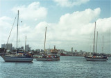
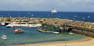
It is a natural anchorage place, just off the breakwater, which provides protection for the dinghy when landing. However, this anchorage is reported to be rolly. In the winter months (July) the seas here are generally calm.
A stone pier was built for tieing up small ships. Bigger ships remain anchored about 500 m from the beach, as there is a sinked greek ship - the Eleani Sthatathos - in the harbour.

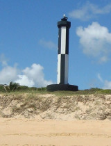
In the proximity there is the Sto. Antonio Fort, which is partly destryoed; it was the first of the main island forts and its name was taken over by the entire region.

Visiting yachts are also allowed to anchor along the shore between the harbour and the twin islands of Dois Irmaos. This is the only area in the National Park with no anchoring restrictions.

Anchor in 10 to 14m over hard sand (and rock).
2016/01/12
Update
Joëlle
Bahia de Santo Antonio (F de Noronha N Brazil)
2016-01-12
Update
Anonymous
Ebook

NE Brazil

  • 27 sites
  • 33 photos
  • publication date: 7 Jul 2023
  • .pdf file size: 11 Mb
Ebook

SW Atlantic Ocean

  • 122 sites
  • 136 photos
  • publication date: 9 Jul 2023
  • .pdf file size: 57 Mb
Share your comments or photos on "Bahia de Santo Antonio (F de Noronha N Brazil)"

Sites around Bahia de Santo Antonio (F de Noronha N Brazil)

Flying distances - Direct line

Reserva Biológica Atol das Rocas

84nm
268°
The coral atoll is built on the upper, western part of the flat top of a volcanic seamount on the north east part of the Brazilian continental margin. The seamount rises to a depth of 30 to 15 metres (98 to 49 ft) below the surface. The distance from the reef ...
21 Feb 21
azerty

Cabo de Sao Roque (Rio Grande do Norte)

197nm
239°
sandy point, about 55m high, with vegetation on its summit. It is closest to the continent of Africa. It also marks the separation of French Guiana (where the coast is low and swampy) and the State of Rio Grande do Norte that offers to S, a massive coast with many coves and bays.

Finally, ...
6 Apr 15
Joëlle

Iate Clube do Natal (Rio Grande do Norte Brazil)

203nm
235°
The Iate Clube do Natal marina is in the town of Monsenhor Gil (Brazil).

Visiting yachtsmen welcomed. Good general repair facilities. Water, showers (cold water), bar and restaurant. (Pool & recreational facilities not open to visitors). Wifi and laundry services available. ...
13 Jan 16
Joëlle

Porto do Natal (Rio Grande do Norte Brazil)

203nm
235°
The port of Natal is situated at the mouth of the Rio Pontengi. The river flows into the sea through an opening in the barrier reef. The barrier reef forms a natural breakwater for the port.
The prevailing winds most of the year are from the ENE to SE.Formalities can be carried ...
13 Jan 16
Joëlle