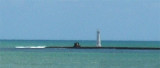
The port of Natal is situated at the mouth of the Rio Pontengi. The river flows into the sea through an opening in the barrier reef. The barrier reef forms a natural breakwater for the port. The prevailing winds most of the year are from the ENE to SE.Formalities can be carried ...
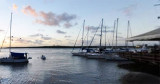
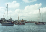
The Iate Clube do Natal marina is in the town of Monsenhor Gil (Brazil).
Visiting yachtsmen welcomed. Good general repair facilities. Water,
showers (cold water), bar and restaurant. (Pool & recreational
facilities not open to visitors). Wifi and laundry services available. ...
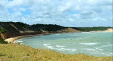
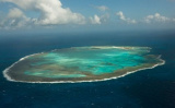
sandy point, about 55m high, with vegetation on its summit. It is closest to the continent of Africa.
It also marks the separation of French Guiana (where the coast is low and swampy) and the State of Rio Grande do Norte that offers to S, a massive coast with many coves and bays.


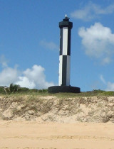
 Ponta da Tabatinga is about 18 miles SSE of Natal. It is of a reddish color and marked by a light.
 Ponta da Tabatinga est située à environ 18 miles au SSE de NataL. Elle est de couleur rouge et marquée par un feu.
")