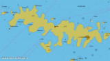
Luka Hvar

Luka Hvar

To precisely geolocate this site. Update if necessary.

Localisation

Characteristics

Port
Water
Phone
Electricity
Fuel
First aid
Market
Restaurant
Post
Bank

Description

Luka Hvar

Bearing:180°
2007-07-11
Update
Mobile
Ebook

Splitsko-dalmatinska županija (Split-Dalmatia Coun

  • 155 sites
  • 295 photos
  • publication date: 6 Jul 2023
  • .pdf file size: 97 Mb
Hvar, in the W extremity of the island is an historic town where cars are banned. The port is much frequented by Ferries, hydrofoils and tour boats and yachts.
Part of the quay reserved for the yachts is generally full , the best option is to anchor in the bay.
Approach: the fort that overlooks the town and the ramparts are remarkable.
Approaching by S or E,  move from one side or the other of O. Pokonji Dol marked by a lighthouse and is overwhelmed by the S advanced shallow (5 m).
Proceed to the E of O. Jerolim overwhelmed by several isolated shoals.
Between O. Jerolim and the town of Hvar is O. Galisnik. The main channel to use at night going to the W of the island.
It can also switch between O. Galisnik and O. Hvar by 5 m deep.
Approaching from the W, we take the Pakleni Kanal where the main danger is Hrid Baba, reported by a fire at 0.25 NM N O. Sveti Klement. It turns N O. Galisnik.
If there is room, it wets the bottom of the dock yachts by 3-4 m of water or on shore W port and take a line ashore.
Otherwise, anchor in the bay by staying out of the ferry route and using an anchor light at night.
By strong winds of W and SE swell entering the harbor, making it uncomfortable.
Hvar port is a port of entry in summer.
Tel: +385 21 741007
Fax: +385 21 742099
2011/05/30
Update
Jojo
Luka Hvar
2011-05-30
Update
Jojo
Hvar, à l'extrémité W de l'île, est une ville historique où les voitures sont interdites. Le port est très fréquenté par les Ferries, Hydrofoils et bateaux d'excursion ainsi que des yachts.
La partie du quai réservée à la plaisance est en générale complète, la meilleure option est de mouiller dans la baie.

Approche: le fort qui domine la ville et les remparts sont remarquables.
En approchant par le S ou l'E, passer d'un côté ou l'autre d'O. Pokonji Dol marqué par un phare et qui est débordé au S par une avancée peu profonde (5 m).
Passer ensuite à l'E d'O. Jerolim débordé par plusieurs hauts-fonds isolés.
Entre O. Jerolime et la ville de Hvar se trouve O. Galisnik. Le chenal principal à utiliser de nuit passe à l'W de cette île.
On peut aussi passer entre O. Galisnik et O. Hvar par 5 m de fond.

En approchant par l'W, on prend le Pakleni Kanal où le principal danger est Hrid Baba, signalé par un feu, à 0,25 NM au N d'O. Sveti Klement. On passe au N d'O. Galisnik.

S'il y a de la place, on mouille au fond du quai des yachts par 3 à 4 m d'eau ou sur la rive W du port en portant une amarre à terre.
Sinon, mouiller dans la baie en restant en dehors de la route des Ferries et en utilisant un feu de mouillage de nuit.

Par forts vents d'W et de SE, la houle entre dans le port, le rendant inconfortable.

Le port de Hvar est un port d'entrée d'été.

Tel: +385 21 741007
Fax: +385 21 742099


2011/05/30
Update
Jojo
Luka Hvar
2011-05-30
Update
Jojo
Luka Hvar
Hrid Baba
2011-05-30
Update
Jojo
Luka Hvar
Pokonji Dol
2011-05-30
Update
Jojo
Luka Hvar
Otok Galesnik
2011-05-30
Update
Jojo
Ebook

Dalmacija (Dalmatie)

  • 542 sites
  • 910 photos
  • publication date: 9 Jul 2023
  • .pdf file size: 302 Mb
Share your comments or photos on "Luka Hvar"

Sites around Luka Hvar

Flying distances - Direct line

Otoci Pakleni

2.6nm
258°
Plakeni islands, or Cursed Islands, are located at the W and S of Hvar town.

The islands are rocky, covered with bushes and trees. They are usually deserted, except in summer.
They offer many choices of moorings sheltered and there is a marina Palmizana.The islands'name ...
26 May 11
Jojo

Starogradski Zaljev Hvar

5.2nm
74°
Starogradski is a large deep bay, open to the NW, which houses the city and the port of Stari Grad on its SE end.
There are several bays, including its N side, where it is possible to anchor. On the other side there is an anchor in front Gradisce.
31 May 11
Jojo

Pakleni Kanal

2.4nm
276°
Pakleni Kanal lies between Pakleni Otoci and Otok Hvar.
It is a deep and wide channel, with access at both ends, which leads to Luka Hvar.
This channel is frequented by small vessels with local knowledge and affords good shelter from the bora, although heavy squalls may be encountered.
The ...
30 May 11
Jojo

Otok Ciovo

20nm
342°
Ciovo is an island in the center of the Dalmatian archipelago. This is an area of 28.8 acres (15.3 km length, width of 3.5 km). It culminates at 218 m (Mount Rudin).
O. Ciovo forms the SW side of the entrance and inner part of Kastelanski Zaliv.
At East side, Ciovo is 2km from ...
7 Aug 11
cdg2

Otok Sveti Klement Pakleni

3.5nm
259°
The island Sveti Klement is the largest of the "Pakleni Otoci".
Its area is 5.27 square kilometers and it has 29.891 km of rocky coasts.
A portion of the island, whose highest peak, Glavica, is 94 m high, is covered with scrub and pine woods.
The island is surrounded by ...
27 May 11
Jojo

Otok Svetac (Andrija)

31nm
253°
Otok Svetac (Andrija), 305m high, lies 13 miles ESE of Otocic Jabuka and is generally steep-to. The coast of the island is rocky and reddish in color on the NW side. Its SW end is fronted by a few rocks. Hrid Kamik, a dark and jagged above-water rock, lies 0.7 mile W of the SW extremity ...
25 May 11
Jojo