The coast between Tanjung Jambuair and Ujung Tamiang, about 69 miles SE, is a low, with a few prominent features.From February through May, the higher mountains are occasionally visible. During the remainder of the year they can usually be seen, especially in the morning. Some of ...
Ujung Peureulak (Tanjung Peureulak) is low and sandy point covered with high trees. Bukit Brangkat, 130m high, about 4 miles WSW of the point makes it easy to identify. Gosong Peureula (Peureulak Bank) extends about 4 miles N and 1.5 miles E from Ujung Peureulak. A drying patch ...
Pangkalan Oil Terminal is situated 9.5 miles offshore in the outer approaches to Teluk Aru. The terminal consists of a SPM, connected to the shore by a submarine pipeline, which is marked by several special purpose buoys. Winds—WeatherThe weather is normally fair with moderate ...
Ujung Curam (Steile Hoek) is a point that has been reported to be radar conspicuous. A tall chimney, marked by obstruction lights, stands about 8 miles SSW of the point. Between Tanjung Jambuair and Ujung Curam, 12 miles SE, there are several rivers and creeks. A sandy mud bank, ...


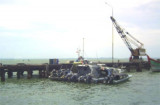
 Kuala Langsa, which is the port for the town of Langsa, stands on the left bank of the Krueng Langsa about 4 miles SW of Tanjung Langsa.