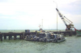

Pangkalan Oil Terminal (NE Sumatra)
Winds—WeatherThe weather is normally fair with moderate ...
| Latitude | Longitude | |
| DMS | --- | --- |
| DM | --- | --- |
| DD | --- | --- |

 The coast between Tanjung Jambuair and Ujung Tamiang, about 69 miles SE, is a low, with a few prominent features.From February through May, the higher mountains are occasionally visible. During the remainder of the year they can usually be seen, especially in the morning. Some of the peaks are good landmarks and can best be seen on the chart.
Ujung Tamiang may be identified from all directions by the groups of casuarina trees standing on either side of the Sungai Tamiang, and which are visible from a considerable distance. From the NW and SE the point appears as an islet from any distance.
A lighthouse is shown on a 40 m skeletal tower, painted white is located on a low cape about 16 km N of Belawan.
The Sungai Tamiang, which discharges about 0.5 mile W of Ujung Tamiang, has no commercial value to shipping.
The coast between Ujung Tamiang and Tanjung Tanjung, about 97 miles SE, is low, thickly covered with vegetation, and marshy. The numerous rivers which discharge along this stretch of coast are available only to small craft with but few exceptions.
The appearance of the coast is very monotonous and it is not always easy to fix a position without local knowledge.
At certain times of the year and in the early morning, many of the mountain peaks in the interior are usually visible and serve as valuable aids to the navigator. The positions of these various peaks may best be seen on the chart.
Ebook | Sumatra (Indonesia)
|


