Ujung Curam (Steile Hoek) is a point that has been reported to be radar conspicuous. A tall chimney, marked by obstruction lights, stands about 8 miles SSW of the point.
Between Tanjung Jambuair and Ujung Curam, 12 miles SE, there are several rivers and creeks. A sandy mud bank, which dries in places, extends from 0.5 to 1.5 miles offshore between Tanjung Jambuair and Ujung Curam. Between Tanjung Jambuair and Ujung Curam, during the NW setting current, there is a distinct division between the muddy water from the rivers and the clearer water of the strait, extending out to the 40m curve.
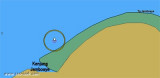
Tanjung Jambuair (Diamond Point) consists of a sandy point, just above water, which is marked by some casuarina trees. The coast in the vicinity appears to be receding to the W.On the cape a 44 m skeletal tower
on an octagonal base, is located about 0,5 miles WSW of the point. It's ...
Krueng Jambuair (Djambo Aje or Jamboaye) flows into the sea about 1 mile WSW of Tanjung Jambuair. The sea usually breaks over the bar at LW, with discolored water from the river sometimes extending as much as 4 miles from the mouth.
Tengah, a coral reef, has a least depth of 7.5m and depths from 21.9 to 25.6m around it. The reef lies 5 miles offshore, with Tanjung Jambuair bearing 100°, distance 7.3 miles. Minyak, a 16.5m patch, lies 2 mile NNW of Tengah.
Ujung Peureulak (Tanjung Peureulak) is low and sandy point covered with high trees. Bukit Brangkat, 130m high, about 4 miles WSW of the point makes it easy to identify. Gosong Peureula (Peureulak Bank) extends about 4 miles N and 1.5 miles E from Ujung Peureulak. A drying patch ...
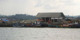
Old Lhokseumawe Harbor has a small pier 60m long, with a 2.4m depth alongside. Only barges and small vessels under 500 dwt can berth there. Old Lhokseumawe Harbor can be readily identified by a ridge of hills, 152m high, clear of trees and grass covered.Channel depth in LHOKSEUMAWE ...
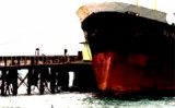
Ug Hagu consist of a single quay with a length of 20m, a width of 5m, and a depth alongside of 7m. Vessels are restricted from berthing during night time at Lhokseumawe/Ug
Hago Wharf or Blanglancang SBM/MBM. Blanglancang Harbor is open for 24
hour service.


 Ujung Curam (Steile Hoek) is a point that has been reported to be radar conspicuous. A tall chimney, marked by obstruction lights, stands about 8 miles SSW of the point.