| Latitude | Longitude | |
| DMS | --- | --- |
| DM | --- | --- |
| DD | --- | --- |

 Pangkalan Oil Terminal is situated 9.5 miles offshore in the outer approaches to Teluk Aru. The terminal consists of a SPM, connected to the shore by a submarine pipeline, which is marked by several special purpose buoys.
The weather is normally fair with moderate variable winds. During the Northeast Monsoon, there are often strong NE winds with heavy rain, showers, and thunderstorms.
The tidal currents in Teluk Aru set generally in the direction of the channels and attain a rate of 2 knots at springs. Outside the outer bar of Alur Pelayaran Sembilan, the flood sets SW and the ebb ets NNE. The ebb often continues to run over the outer bar for some time after the flood has ceased in the Strait of Malacca outside the shoals.
The SPM can accommodate tankers up to 150,000 dwt, with a length of 275m. Depths in the vicinity vary from 18 to 25m.
Pulau Kumpai and Pulau Sembilan are low but have tall trees visible for a distance of 15 miles from seaward.
Pilotage is compulsory and reported available 24 hours.
Vessels are required to send their ETA 72 hours, 48 hours, and 24 hours in advance, with the first message to include the type of cargo required.
Berthing may only take place during daylight; unmooring is permitted 24 hours. A restricted area encloses the SPM and undersea pipeline.
The tanker anchorage area is situated approximately 2 miles E of the SPM. It is also reported that a tanker anchorage exists in position 4°16'N, 98°25'E where vessels await the arrival of the pilot. At this anchorage the pilot boards with the Loading Master and the crew. Dry cargo vessels may anchor in position 4°16'N, 98°22.3'E to await the pilot.
Tankers approaching the SPM from the NW or NE can pass on either side of the buoy situated approximately 1.5 miles N of the SPM. It is reported that the approach to the SPM is not difficult to identify as Teluk Aru presents a very good radar picture. The SPM, however, may be difficult to identify ue to the presence of fishing huts and boats in the vicinity.
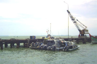
Pangkalan (Pangkalansusu) consists of several small oil jetties, a general cargo wharf, and the offshore SPM. The port is used primarily by small tankers operating between the port and the offshore SPM. Tankers up to 5,000 dwt, with a length of 142m and a draft of 6m, can be accommodated.
A vessel approaching the entrance of Alur Pelayaran Sembilian should keep outside the 20m curve until the lighted fairway buoy is sighted.
As the distance between the outer and inner bars is about 10 miles and HW is about 30 minutes earlier on the inner bar than on the outer bar, vessels are advised to cross the outer bar on a flood tide, leaving the lighted fairway buoy at least 30 minutes before HW. The bottom generally is soft mud except on the inner bar.
Tel: +62 620 51024
Fax: +62 620 51024

Ebook | Sumatra (Indonesia)
|


