Cala Pinetto (Palmas Sardegna)

Cala Pinetto (Palmas Sardegna)

To precisely geolocate this site. Update if necessary.

Localisation

Cala Pinetto (Palmas Sardegna)
LatitudeLongitude
DMS------
DM------
DD------

Characteristics

Mooring
Sand
Beach
Sand

Description

This small cove is just N punta Manga.

It offers a good ancorage only by good weather or with Sirrocco.

2012/10/26
Update
Joëlle
Cette petite anse se trouve immédiatement au N de la pointe Manga.

Elle offre un bon mouillage seulement par beau temps ou avec du Sirrocco.

2012/11/4
Update
Questa piccola cala si trova immediatamente a N di capo Menga.

Offra un buon ancoraggio solo con bel tempo o con scirocco.

2012/11/4
Update
Cala Pinetto (Palmas Sardegna)
2012-11-04
Update
Cala Pinetto (Palmas Sardegna)
2012-11-04
Update
Ebook

Sardegna South

  • 72 sites
  • 178 photos
  • publication date: 11 Jul 2023
  • .pdf file size: 38 Mb
Share your comments or photos on "Cala Pinetto (Palmas Sardegna)"

Sites around Cala Pinetto (Palmas Sardegna)

Flying distances - Direct line

Punta Menga (Porto Pino Sardegna)

0.3nm
160°
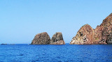
Punta Menga (or Punta Candiani) is located W Porto Pino. It is covered with low végétation and is 31 m high. The tip is known locally as Candiani. The name comes from the anti-aircraft battery-called anti-ship, of Admiral Camillo Candiani, located on Punta Menga.
26 Oct 12
Joëlle

Porto Pino (Palmas Sardegna)

0.6nm
118°
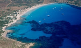
Porto Pino is bordered in its southern part by a rocky coastline with high dunes. N coast is formed instead of a low range. The tip Menga limits Porto Pino W. A lagoon, behind the sand dunes, homes  several colonies of flamingos.

This huge sandy bay provides anchorage ...
26 Oct 12
Joëlle

Cala Zafferaneddu (Palmas Sardegna)

3.1nm
151°
Cala Zafferaneddu is still one of the numerous coves that is in the area of ​​the polygon Teulada military, it is accessible only during the summer.

It is characterized by a mixture of pebbles and sand and white and has the distinction of having the highest sand dunes covered ...
25 Oct 12
Joëlle

Punta di Cala Piombo (Palmas Sardegna)

4.1nm
167°
Cala Piombo point has a tower which  was built in 1639. It also lies within the polygon Military of Cape Teulada, on a hill 193 m high.

In about1/2 NM of the promontory is a reef (secca di cala Piombo) that rises up to 2 m from the surface and in the past, was responsible ...
25 Oct 12
Joëlle

Porto Botte (Palmas Sardegna)

4.9nm
343°
The large bay of Porto Botte is located between the tip of Porto Botte to S and the mouth of the river Palmas to N. It faces the island of Sant 'Antioco. The pond Porto Botte is just behind the beach along the bay.

Must stay away from the beach because the funds back quickly.  ...
26 Oct 12
Joëlle

Porto di Teulada (Sardegna)

6.8nm
106°
Porto Teulada is a small bay that lies in N Teulada gulf.W bay, Rossa island stands on the coast.Anchorage by 16 m . Beware to shoals tha lie NE of the Niedda point.
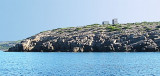
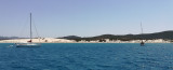
22 Oct 12
Joëlle