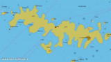
Uvala Stoncica is a beautiful sheltered inlet at the east end of Vis.
The bay is narrow and for much of its length shallow, with a small
sandybeach at its west end where there are several small tavernas
serving simple food.
We can anchor in front of the restaurants or in one of two creeks in the W, less than 10 m. Good protection, except against N and NE.
2011/05/23
Update
Jojo
Uvala Stoncica est une belle baie abritée à l'extrémité E de Vis. La baie est étroite et une grande partie de celle-ci est de faible profondeur, avec une petite plage de sable à son extrémité W, où il y a plusieurs petites tavernes servant des repas simples.
On peut mouiller face aux restaurants ou dans l'une des deux criques à l'W, par moins de 10 m.
Otok Svetac (Andrija), 305m high, lies 13 miles ESE of Otocic Jabuka and is generally steep-to. The coast of the island is rocky and reddish in color on the NW side. Its SW end is fronted by a few rocks. Hrid Kamik, a dark and jagged above-water rock, lies 0.7 mile W of the SW extremity ...
Plakeni islands, or Cursed Islands, are located at the W and S of Hvar town.
The islands are rocky, covered with bushes and trees. They are usually deserted, except in summer. They offer many choices of moorings sheltered and there is a marina Palmizana.The islands'name ...
Ciovo is an island in the center of the Dalmatian archipelago. This is an area of 28.8 acres (15.3 km length, width of 3.5 km). It culminates at 218 m (Mount Rudin). O. Ciovo forms the SW side of the entrance and inner part of Kastelanski Zaliv. At East side, Ciovo is 2km from ...
Pakleni Kanal lies between Pakleni Otoci and Otok Hvar. It is a deep and wide channel, with access at both ends, which leads to Luka Hvar. This channel is frequented by small vessels with local knowledge and affords good shelter from the bora, although heavy squalls may be encountered. The ...
The island Sveti Klement is the largest of the "Pakleni Otoci".
Its area is 5.27 square kilometers and it has 29.891 km of rocky coasts. A portion of the island, whose highest peak, Glavica, is 94 m high, is covered with scrub and pine woods. The island is surrounded by ...
Starogradski is a large deep bay, open to the NW, which houses the city and the port of Stari Grad on its SE end. There are several bays, including its N side, where it is possible to anchor. On the other side there is an anchor in front Gradisce.


 Bonne tenue


 Uvala Stoncica is a beautiful sheltered inlet at the east end of Vis.
The bay is narrow and for much of its length shallow, with a small
sandybeach at its west end where there are several small tavernas
serving simple food.
Uvala Stoncica is a beautiful sheltered inlet at the east end of Vis.
The bay is narrow and for much of its length shallow, with a small
sandybeach at its west end where there are several small tavernas
serving simple food.
 Uvala Stoncica est une belle baie abritée à l'extrémité E de Vis. La baie est étroite et une grande partie de celle-ci est de faible profondeur, avec une petite plage de sable à son extrémité W, où il y a plusieurs petites tavernes servant des repas simples.