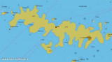
Uvala Pribinja Hvar

Uvala Pribinja Hvar

To precisely geolocate this site. Update if necessary.

Localisation

Characteristics

Grass
Mooring buoy
Mooring
Sand
Grocery au camping
Restaurant Kanoba Ringo
Windsurf

Description

On the N shore of O. Hvar, near its Western end is the large inlet of Uvala Pribinja. This bay has two arms, to the W is the harbour of Vira and to the E is uvala Pribinja.

The eastern arm provides an excellent, sheltered anchorage in a very pleasant surrounding.

At the back of the bay you will find 4 mooring buoys owned by and maintained by the Konoba Ringo.

The buoys leave no space for anchoring in the inner bay, so those wanting to drop a hook would need to do so further out in depths of between 8-15 metres. It is recommended to take a line ashore for additional security, particularly in a Bora.

Shelter:Good all around shelter can be obtained in various parts of Uvala Pribinja and Vira, depending on where the weather is coming from.

2011/05/31
Update
Jojo
Uvala Pribinja Hvar
2011-05-31
Update
Jojo
Sur la rive nord de O. Hvar, près de son extrémité occidentale est l'entrée de la grande Uvala Pribinja. Cette baie a deux bras, à l'Ouest se trouve le port de Vira et à l'E est située la baie de Pribinja.
Le bras oriental offre un excellent mouillage abrité dans un très agréable environnement.
Au fond de la baie, vous trouverez 4 bouées d'amarrage appartenant et gérées par le Ringo Konoba (restaurant).
Les bouées ne laissent aucun espace pour l'ancrage dans la baie intérieure, de sorte que ceux qui veulent déposer l'ancre  divent le faire plus loin dans des profondeurs variant entre 8-15 mètres. Il est recommandé de prendre une ligne à terre pour plus de sécurité, en particulier en cas de Bora.
Abris: Bon dans les différentes parties de Uvala Pribinja et Vira, et dépend d'où vient le vent.
2011/05/31
Update
Jojo
Uvala Pribinja Hvar
2011-05-31
Update
Jojo
Uvala Pribinja Hvar
2011-05-31
Update
Jojo
Ebook

Splitsko-dalmatinska županija (Split-Dalmatia Coun

  • 157 sites
  • 295 photos
  • publication date: 7 Aug 2024
  • .pdf file size: 109 Mb
Share your comments or photos on "Uvala Pribinja Hvar"

Sites around Uvala Pribinja Hvar

Flying distances - Direct line

Otoci Pakleni

2.9nm
230°
Plakeni islands, or Cursed Islands, are located at the W and S of Hvar town.

The islands are rocky, covered with bushes and trees. They are usually deserted, except in summer.
They offer many choices of moorings sheltered and there is a marina Palmizana.The islands'name ...
26 May 11
Jojo

Starogradski Zaljev Hvar

5.3nm
89°
Starogradski is a large deep bay, open to the NW, which houses the city and the port of Stari Grad on its SE end.
There are several bays, including its N side, where it is possible to anchor. On the other side there is an anchor in front Gradisce.
31 May 11
Jojo

Pakleni Kanal

2.3nm
243°
Pakleni Kanal lies between Pakleni Otoci and Otok Hvar.
It is a deep and wide channel, with access at both ends, which leads to Luka Hvar.
This channel is frequented by small vessels with local knowledge and affords good shelter from the bora, although heavy squalls may be encountered.
The ...
30 May 11
Jojo

Otok Ciovo

18nm
341°
Ciovo is an island in the center of the Dalmatian archipelago. This is an area of 28.8 acres (15.3 km length, width of 3.5 km). It culminates at 218 m (Mount Rudin).
O. Ciovo forms the SW side of the entrance and inner part of Kastelanski Zaliv.
At East side, Ciovo is 2km from ...
7 Aug 11
cdg2

Otok Sveti Klement Pakleni

3.8nm
237°
The island Sveti Klement is the largest of the "Pakleni Otoci".
Its area is 5.27 square kilometers and it has 29.891 km of rocky coasts.
A portion of the island, whose highest peak, Glavica, is 94 m high, is covered with scrub and pine woods.
The island is surrounded by ...
27 May 11
Jojo

Otok Svetac (Andrija)

31nm
251°
Otok Svetac (Andrija), 305m high, lies 13 miles ESE of Otocic Jabuka and is generally steep-to. The coast of the island is rocky and reddish in color on the NW side. Its SW end is fronted by a few rocks. Hrid Kamik, a dark and jagged above-water rock, lies 0.7 mile W of the SW extremity ...
25 May 11
Jojo