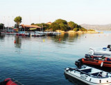
Large beach between Murra Point and La Barca Bruciata point.
The bay offers good anchor during the day. Near the beach, the promontory houses a campsite that offers many facilities including a jetty with a small dock.
Barca Bruciata beach excellent shelter for boats, especially when the mistral blows, ensuring a flat sea and a good resistance to the anchor.
2012/09/7
Update
Joëlle
Grande plage entre Pta Murra et Pta La Barca Bruciata.
La baie offre un bon mouillage pendant la journée. Près de la plage, le promontoire abrite un camping qui propose de nombreux équipements dont un ponton avec un petit quai.
La plage de Barca Bruciata un excellent abri pour les bateaux de plaisance, surtout quand le mistral souffle, assurant une mer plate et une bonne tenue à l'ancre.
2012/09/7
Update
Joëlle
Grande spiaggia tra Pta Murra e Pta La Barca Bruciata.
L’insenatura offre un buon ancoraggio
diurno. Accanto alla spiaggia, il promontorio dell’Isuledda ospita un
camping, che offre numerosi servizi fra cui un pontile d’attracco con
una piccola darsena.
La spiaggia di Barca Bruciata costituisce un ottimo
ridosso per le imbarcazioni da diporto, specie quando soffia il
Maestrale, garantendo un mare piatto e una buona tenuta all’ancoraggio.
It is the largest island of the archipelago composed of sixty islets and 7 major islands, in the NE end tip of Sardinia. It is mountainous and arid. This is the only inhabited island thoroughly. It is connected by a bridge to Caprera island where are the house and the tomb of Garibaldi. ...
Gulf of Arzachena (Arsachena), located between Punta Saline and Tre Monti Cape, is a high inlet whose banks are lined with shoals. S tip, Arzachena, W of the entrance, a beacon consists of an iron post with a sheer spherical white marks a rock particularly ...
La tourelle Pecorella marque l'entrée de ce golfe qui s'enfonce à plus de 4 M dans les terres. Celle de Chiapino qui était plus au S est démolie. Il faut donc remonter suffisamment vers le N pour ne pas risquer d'en toucher les restes. En piquant vers l'W, la balise noire délimite ...
A little less than 1 NM to the E of Ventotene island, there is the island of Santo Stefano, the smallest of the archipelago.
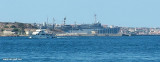
This island is occupied by the army. Currently there is a NATO base on the island of Santo Stefano. The NATO base housed an Italian Marine barracks ...
Tavolara island is a limestone massif 6 kilometres long and 500 m wide, and 565 m high.The overhanging cliffs make it inaccessible, with the exception of a bay and a beach that is located at each end of the island, Spalmatore di Fuori northeast (military zone) and Spalmatore di Terra ...


 Large beach between Murra Point and La Barca Bruciata point.
  Grande plage entre Pta Murra et Pta La Barca Bruciata.
 Grande spiaggia tra Pta Murra e Pta La Barca Bruciata.
")
")