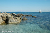
Mal di Ventre island takes its name the difficulties encountered by sailors to navigate its waters. Located opposite the Peninsula del Sunis, low and flat, 18 m high, it has an area of 80 hectares. A light is shown from a structure, 4m high, standing on the summit of the ...
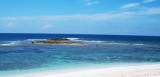
The park begins at Capo Galera to continue toward the gulf of Porto Conte that is protected by two promontories, Punta Giglio and Capo Caccia-Monte Timidone. The marine protected area embraces the stretch of sea to the north-west of Punta Cristallo.Almost all of the park consists ...
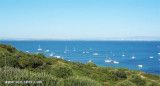
The Phoenicians settled in Tharros to 800 BC, then came the turn of the Carthaginians in 500 BC. Port Tharros became a place of passage and a strong center of commercial activity. Its privileged position within the Sinis peninsula, protected from the mistral, the fertility ...


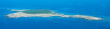


 AMP del Sinis_I Mal di Ventre
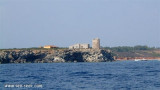
 Il Catalano rock, 11 m high, is 7,5 NM WNW of San Marco cape.
 Le rocher Il Catalano, haut de 11m, est à 7,5 M à l'WNW du cap S.
Marco.
Le rocher Il Catalano, haut de 11m, est à 7,5 M à l'WNW du cap S.
Marco. Il scoglio Catalano, 11 m alto, è a 7,5 MN all'WNW da capo S. Marco.
")
")