Rt Bat

Rt Bat

To precisely geolocate this site. Update if necessary.

Localisation

Characteristics

Description

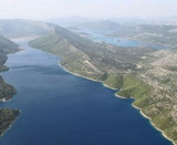
Rt Bat, the W entrance point of Luka Zaton, is located 1 mile NNW of Otocic Daksa.

Caution.—A submarine pipeline extends 0.8 mile S from a point on the coast 0.4 mile E of Rt Petka.
A submarine cable, extends inshore along the coast between Ostri Rt and Hridi Grebeni.
Several submarine cables and a pipeline extend between the N side of Otok Lokrum and the mainland.

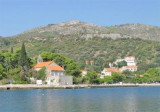
Rt Bat, marked by a lights shown from a tower, 6m high, is the steep-to extremity of a wooded peninsula which borders the W side of Luka Zaton.
The coast to the N of this point is rocky, steep-to, and is backed a short distance inland by mountainous country with little intervening space of cultivated ground.

2011/04/15
Update
Jojo
Rt Bat, le point d'entrée W de Luka Zaton, est situé à 1 mile au NNW de Otocic Daksa.
Attention.-Un gazoduc sous-marin s'étend 0.8 mile au S à partir d'un point situé sur la côte E   0,4 mile de Rt Petka.
Un câble sous-marin, s'étend le long de la côte entre Rt Ostri et Hridi Grebeni.
Plusieurs câbles sous-marins et un pipeline s'étendent entre la côte au N de Otok Lokrum et le continent.
Rt Bat, marqué par un feux posé sur une tour, haute de 6m, s'étend à l'extrémité d'une péninsule boisée qui borde le côté ouest de Luka Zaton.
La côte au Nord de ce point est rocheuse, abrupte, et est bordée à une courte distance à l' intérieure par des montagnes avec des espaces de terre cultivée.
2011/04/15
Update
Jojo
Ebook

Dubrovačko-neretvanska županija (Dubrovnik–Neretva

  • 140 sites
  • 228 photos
  • publication date: 6 Aug 2024
  • .pdf file size: 79 Mb
Ebook

Dalmacija (Dalmatie)

  • 568 sites
  • 963 photos
  • publication date: 5 Aug 2024
  • .pdf file size: 350 Mb
Share your comments or photos on "Rt Bat"

Sites around Rt Bat

Flying distances - Direct line

Otok Sipan

7.4nm
289°
It is the largest and most populated island of the group Elafiten. It rises to 234 m at its N and a prominent hill rises 224 m NW of the SE end.
Ruda is a small island that is 0.5 M SE of the NE extremity of the island and Misnjaka, 13 m high, lies close off the NW extremity.
...
16 Apr 11
Jojo

Otok Lopud

3.9nm
270°
The island of Lopud belongs Elaphites. It is only 4.6 km2.
It has a pleasant village and some old buildings. You'll find a sandy beach.
There are two good anchorages: uvala Lopud (NW of the island), where is the village and uvala Sunj (SE of the island).
15 Apr 11
Jojo

Otok Kolocep

1.8nm
245°
Kolocep island is located two NM from Dubrovnik. This small island is part of the archipelago of islands Elafiten.
Locals also call it Kalamota. Its area is 2.35 km2.
On the island there are two villages in the two largest bays of the island: Gornje Celo and Donje Celo that ...
15 Apr 11
Jojo

Zupski Zaliv

8.9nm
123°
Zupski Zaliv is entered between Rt Sustjepan and Rt Pelegrin, 2.5 miles NW. The E and SE shores of this bay are backed by mountains, but a valley through which a river flows lies within the N shore.
Malastica, 628m high, stands 1 mile N of the bay. This hill has a somewhat sharp ...
13 Apr 11
Jojo

Stonski Kanal

15nm
298°
Stonski Kanal, a deep inlet, indents the SE end of Poluotok Peljesac at the NW end of Kolocepski Kanal.
Its shore rises rapidly on each side and provides protection from NE and SW winds. The village of Brocej is situated on the S shore 3.8 miles within the entrance.
It is fronted ...
25 Apr 11
Jojo

Uvala Zaton

0.3nm
334°
Located in a nice little sheltered inlets, Zaton offers a small port and several anchorages.
The entrance is about 1 NM NNE of otocic Daksa. The fire of Ruth Bat, W of the entrance to help identify him.
Beware of submerged rocks to the east of the port, covered by 4.5 m of water.
We ...
15 Apr 11
Jojo