The entrance of the dredged channel leading to the Sungai Deli leads through these shoals to Pulau Belawan which has the port of Belawan on its N side.
The Sungai Deli has two entrances separated by Pulau Belawan. The Sungai Belawan, the N channel, has the port of Belawan along its S side; the Sungai Deli, the S channel, leads S of Pulau Belawan. The S channel is no longer in use.
Numerous fishing stakes stand on the shoal area in the approach to Belawan.
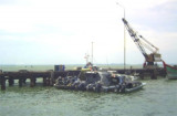
Belawan, the most important port in Sumatera, lies at the confluence of the Sungai Belawan and the Sungai Deli about 8 miles S of the lighted approach buoy. Ample, modern alongside berthing facilities are available for handling all classes of ocean-going vessels capable of transiting ...
Tanjung Perling is located in the area of Utara in Sumatera with an average elevation of 103 m above the sea. The coast between Tanjung Perling and the mouth of the Sungai Serdang, about 8 miles SE, consists of mud and mangroves but from there to Teluk Mengkudu, about 18 miles ...
Tanjung Beting Camar, which is tree-covered, stands 1.2 miles SE of Sungai Nipah Larangan. The coast between this point and Tanjung Belawan, about 6.2 miles SSE, has been reported to be radar conspicuous.Between Tanjung Beting Camar and Tanjung Perling, about 10 miles SSE, the coast ...
Pangkalan Oil Terminal is situated 9.5 miles offshore in the outer approaches to Teluk Aru. The terminal consists of a SPM, connected to the shore by a submarine pipeline, which is marked by several special purpose buoys. Winds—WeatherThe weather is normally fair with moderate ...
The coast between Tanjung Jambuair and Ujung Tamiang, about 69 miles SE, is a low, with a few prominent features.From February through May, the higher mountains are occasionally visible. During the remainder of the year they can usually be seen, especially in the morning. Some of ...


 The entrance of the dredged channel leading to the Sungai Deli leads through these shoals to Pulau Belawan which has the port of Belawan on its N side.