Otok Brac (Dalmacie)

Otok Brac (Dalmacie)

To precisely geolocate this site. Update if necessary.

Localisation

Characteristics

Coast

Description

Otok Brac (Dalmacie)
2008-09-26
Update
Ebook

Splitsko-dalmatinska županija (Split-Dalmatia Coun

  • 155 sites
  • 295 photos
  • publication date: 6 Jul 2023
  • .pdf file size: 97 Mb
Brac, the largest (45 km to 12 km), the highest (780m) and the more varied of the islands of Central Dalmatia, has been inhabited since the Neolithic period.
Brac is located on the same latitude as Corsica and faces the east coast of Italy, is the southern island of Croatia.
There are 15 major sites worth visiting in diving, especially in the unfrequented channel separating the island of Brac to Hvar, but also around the islands of Vis and Solta. Stine Babice with its Roman mosaics, the wreck of the early 19th Tatinja with coins and pottery, Lucica cave whose entrance is 3 m and depth 30 m.
Visibility is often greater than 30 m. Deep caves, tunnels, drop offs are scheduled. We see easily octopus, seahorses, tuna, sea bream, lobster, red mullet, bream, red and yellow sea fans, black coral.
Brac is also famous for its stone quarries. Pucisca career is remarkable the wide and is still exploited.
This is the ideal destination for surfers and those who love water sports.
2011/07/5
Update
Jojo
Ebook

Dalmacija (Dalmatie)

  • 542 sites
  • 910 photos
  • publication date: 9 Jul 2023
  • .pdf file size: 302 Mb

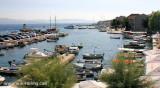
Brac, la plus grande (45 km sur 12 km), la plus haute (780m) et la plus contrastée des îles de la Dalmatie Centrale, est habitée depuis l'époque néolithique.
Brac se trouve sur la même latitude que la Corse et fait face à la côte Est italienne, c'est l'île sudiste de la Croatie.
On y trouve 15 sites majeurs qui méritent d'être visités en plongée sous-marine, principalement dans le canal peu fréquenté séparant Brac de l'île de Hvar, mais aussi autour des îles de Vis et Solta. Babice Stine avec ses mosaïques romaines, l'épave Tatinja du début 19ème avec ses pièces et poteries, la grotte Lucica dont l'entrée se situe à 3 m et la profondeur 30 m.
La visibilité est souvent supérieure à 30 m. Grottes profondes, tunnels, tombants sont au programme. Nous observons facilement les poulpes, hippocampes, thons, dorades, langoustes, rougets, sars, gorgones rouges et jaunes, corail noir.
Brac est célèbre aussi pour ses carrières de pierre. La carrière de Pucisca est remarquable du large et est encore exploitée.
C'est la destination idéale pour les surfeurs et tous ceux qui aiment les sports aquatiques.
2011/07/5
Update
Jojo
Share your comments or photos on "Otok Brac (Dalmacie)"

Sites around Otok Brac (Dalmacie)

Flying distances - Direct line

Starogradski Zaljev Hvar

8.9nm
208°
Starogradski is a large deep bay, open to the NW, which houses the city and the port of Stari Grad on its SE end.
There are several bays, including its N side, where it is possible to anchor. On the other side there is an anchor in front Gradisce.
31 May 11
Jojo

Otok Ciovo

18nm
302°
Ciovo is an island in the center of the Dalmatian archipelago. This is an area of 28.8 acres (15.3 km length, width of 3.5 km). It culminates at 218 m (Mount Rudin).
O. Ciovo forms the SW side of the entrance and inner part of Kastelanski Zaliv.
At East side, Ciovo is 2km from ...
7 Aug 11
cdg2

Otoci Pakleni

15nm
230°
Plakeni islands, or Cursed Islands, are located at the W and S of Hvar town.

The islands are rocky, covered with bushes and trees. They are usually deserted, except in summer.
They offer many choices of moorings sheltered and there is a marina Palmizana.The islands'name ...
26 May 11
Jojo

Pakleni Kanal

14nm
232°
Pakleni Kanal lies between Pakleni Otoci and Otok Hvar.
It is a deep and wide channel, with access at both ends, which leads to Luka Hvar.
This channel is frequented by small vessels with local knowledge and affords good shelter from the bora, although heavy squalls may be encountered.
The ...
30 May 11
Jojo

Uvala Vela Luka Korcula

21nm
177°
Zaljev Vela Luka is a large bay on the E O. Korcula. Many coves occupy the bay. At the bottom of it is the port of Vela Luka, an active and well sheltered.
Easily identifiable by day or night, you can enter this great bay in all weather.
Dangers in the general approach are the ...
21 May 11
Jojo

Bol (Brac)

3.8nm
177°

C'est le plus grand village de la côte S de Brac. On peut s'amarrer au quai dans le port, ou le long du brise-lames. On peut aussi mouiller au poste de carburant, mais ce n'est pas tellement abrité. Tel: +385.21.635.367 Fax: +385.21.635.367 E-mail: ncb@mail.inet.hr
1 Oct 08