Luka Stari Grad Hvar

Luka Stari Grad Hvar

To precisely geolocate this site. Update if necessary.

Localisation

Characteristics

Port
Water
Phone
Electricity
First aid
Mechanical repair
Market
Grocery marché
Restaurant
Post
Bank

Description

Stari Grad ("Stari" translates as "old " and "grad" as "city" in Croatian). One of the oldest cities in Europe, is at the end of Starogradski Zaljev.
The oldest part of Stari Grad is a protected World Heritage Site by UNESCO.
No danger in the approach.
Stari Grad is a ferry port.
A fire is located on the platform of the S green buoy indicating a rocky spur. Allowing this to go to starboard buoy moored at Pier S, E, green buoy.
Good protection except the NW and W.
Port of entry in the summer.
2011/05/31
Update
Jojo
Luka Stari Grad Hvar
2011-05-31
Update
Jojo
Stari Grad,  ("Stari" traduit comme "anciens" et "grad" comme "ville" en croate). une des plus anciennes villes d'Europe, se trouve à la fin de Starogradski Zaljev.
La partie la plus ancienne de Stari Grad est le site protégé du Patrimoine Mondial de l'UNESCO.

Pas de danger dans l'approche.

Stari Grad est un port de Ferries.
Un feu est situé sur le quai au S d'une bouée verte indiquant un épi rocheux. On laisse cette bouée à Tribord pour aller s'amarrer au quai S, à l'E de la bouée verte.

Bonne protection sauf du NW et de l'W.

Port d'entrée en été.

2011/05/31
Update
Jojo
Luka Stari Grad Hvar
2011-05-31
Update
Jojo
Luka Stari Grad Hvar
2011-05-31
Update
Jojo
Luka Stari Grad Hvar
Le port des ferries
2011-05-31
Update
Jojo
Ebook

Splitsko-dalmatinska županija (Split-Dalmatia Coun

  • 157 sites
  • 295 photos
  • publication date: 7 Aug 2024
  • .pdf file size: 109 Mb
Ebook

Dalmacija (Dalmatie)

  • 568 sites
  • 963 photos
  • publication date: 5 Aug 2024
  • .pdf file size: 350 Mb
Share your comments or photos on "Luka Stari Grad Hvar"

Sites around Luka Stari Grad Hvar

Flying distances - Direct line

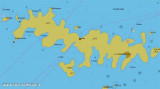
Starogradski Zaljev Hvar

1.7nm
287°
Starogradski is a large deep bay, open to the NW, which houses the city and the port of Stari Grad on its SE end.
There are several bays, including its N side, where it is possible to anchor. On the other side there is an anchor in front Gradisce.
31 May 11
Jojo

Otoci Pakleni

9.3nm
261°
Plakeni islands, or Cursed Islands, are located at the W and S of Hvar town.

The islands are rocky, covered with bushes and trees. They are usually deserted, except in summer.
They offer many choices of moorings sheltered and there is a marina Palmizana.The islands'name ...
26 May 11
Jojo

Pakleni Kanal

9.1nm
266°
Pakleni Kanal lies between Pakleni Otoci and Otok Hvar.
It is a deep and wide channel, with access at both ends, which leads to Luka Hvar.
This channel is frequented by small vessels with local knowledge and affords good shelter from the bora, although heavy squalls may be encountered.
The ...
30 May 11
Jojo

Otok Ciovo

22nm
325°
Ciovo is an island in the center of the Dalmatian archipelago. This is an area of 28.8 acres (15.3 km length, width of 3.5 km). It culminates at 218 m (Mount Rudin).
O. Ciovo forms the SW side of the entrance and inner part of Kastelanski Zaliv.
At East side, Ciovo is 2km from ...
7 Aug 11
cdg2

Otok Sveti Klement Pakleni

10nm
261°
The island Sveti Klement is the largest of the "Pakleni Otoci".
Its area is 5.27 square kilometers and it has 29.891 km of rocky coasts.
A portion of the island, whose highest peak, Glavica, is 94 m high, is covered with scrub and pine woods.
The island is surrounded by ...
27 May 11
Jojo

Uvala Vela Luka Korcula

14nm
165°
Zaljev Vela Luka is a large bay on the E O. Korcula. Many coves occupy the bay. At the bottom of it is the port of Vela Luka, an active and well sheltered.
Easily identifiable by day or night, you can enter this great bay in all weather.
Dangers in the general approach are the ...
21 May 11
Jojo