Korculanski Kanal can be entered from the S, between Otok Vis and Otok Korcula, or from the W via Viski Kanal which leads between Otok Vis and Otok Hvar.
This channel connects with Neretvanski Kanal to the E and is part of the main approach to Kardeljevo. It is easily navigated and vessels may pass on either side of Otok Scedro and Otocic Plocica although the central route is safer for larger vessels.
Caution.—Several submarine cables extend across Korculanski Kanal and Neretvanski Kanal and may best be seen on the chart. The bora sometimes blows with great strength within the vicinity of Korculanski and Neretvanski Kanals. Magnetic anomalies have been experienced within Korculanski Kanal and Neretvanski Kanal.
2011/05/1
Update
Jojo
Korculanski Kanals'étend au S, entre Otok Vis et Otok Korcula, à l'W à partir de Viski Kanal qui sépare Otok Vis et Hvar Otok.
Ce canal se connecte à Neretvanski Kanal à l'E et est l'approche principale pour Kardeljevo. Il est facilement navigable et les navires peuvent passer de chaque côté de Otok Scedro et Otocic Plocica bien que la voie centrale est plus sûr pour les grands navires.
Attention.-Plusieurs câbles sous-marins se trouvent sur Korculanski Kanal et Neretvanski Kanal. La bora souffle parfois avec une grande force dans le voisinage de Korculanski et Kanals Neretvanski. Les anomalies magnétiques ont été rapportées au sein Korculanski Kanal et Neretvanski Kanal.
Starogradski is a large deep bay, open to the NW, which houses the city and the port of Stari Grad on its SE end. There are several bays, including its N side, where it is possible to anchor. On the other side there is an anchor in front Gradisce.
Zaljev Vela Luka is a large bay on the E O. Korcula. Many coves occupy the bay. At the bottom of it is the port of Vela Luka, an active and well sheltered. Easily identifiable by day or night, you can enter this great bay in all weather. Dangers in the general approach are the ...
Plakeni islands, or Cursed Islands, are located at the W and S of Hvar town.
The islands are rocky, covered with bushes and trees. They are usually deserted, except in summer. They offer many choices of moorings sheltered and there is a marina Palmizana.The islands'name ...
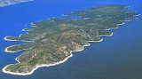
Otok Scedro lies 3 miles E of Hridi Lukavci. It is 2,7 km off the S coast of island of Hvar.The inhabited island is elevated at each end and slopes towards the sea in the middle. Its coastline includes many coves where you can get wet. The two most popular are Uvala Uvala Lovisce ...
Pakleni Kanal lies between Pakleni Otoci and Otok Hvar. It is a deep and wide channel, with access at both ends, which leads to Luka Hvar. This channel is frequented by small vessels with local knowledge and affords good shelter from the bora, although heavy squalls may be encountered. The ...
Otok Svetac (Andrija), 305m high, lies 13 miles ESE of Otocic Jabuka and is generally steep-to. The coast of the island is rocky and reddish in color on the NW side. Its SW end is fronted by a few rocks. Hrid Kamik, a dark and jagged above-water rock, lies 0.7 mile W of the SW extremity ...


 Korculanski Kanal can be entered from the S, between Otok Vis and Otok Korcula, or from the W via Viski Kanal which leads between Otok Vis and Otok Hvar.
 Korculanski Kanals'étend au S, entre Otok Vis et Otok Korcula, à l'W à partir de Viski Kanal qui sépare Otok Vis et Hvar Otok.