Isole Poveri (Sardegna)

Isole Poveri (Sardegna)

To precisely geolocate this site. Update if necessary.

Localisation

Isole Poveri (Sardegna)
LatitudeLongitude
DMS------
DM------
DD------

Characteristics

Island / Atoll
East cardinal

Description

Poveri islands Poor islands are located off the coast between Punta Capaccia and Punta Dei Capriccioli.

The area is shallow with numerous and dangerous rocks: particularly, some of the extreme West, which are located on the route between Mortorio and Passo delle Galere, the usual pass to return to Porto Cervo, and another, at NE, the Secca of Principe.

The group of Poveri islands is reported on the island to the north by an east cardinal beacon  while on the rock, further south there is a white flashing light placed on a tall pole of 4 m.

A deep pass, 0,2 NM wide, lies between the rocks and the coast of Sardinia.

2012/09/17
Update
Joëlle
Isole Poveri (Sardegna)
2012-09-17
Update
Joëlle
Les îles Poveri sont situées au large de la côte entre Punta Capaccia et la pointe de Capriccioli.

La zone est peu profonde avec des affleurements nombreux et dangereux: en particulier, ceux situés à l'extrème W, qui se trouvent sur la route entre Mortorio et la passe des galères, utilisée habituellement pour retourner à Porto Cervo, et le haut-fond del Principe, au NE.

Le groupe des Îles Poveri est signalé sur l'île, au nord, par une balise cardinale Est tandis que sur les rochers plus au sud, il y a un feu clignotant blanc placé sur une perche de 4 m de hauteur.

Une passe profonde, de 0,2 MN de large, se trouve entre les rochers et la côte de la Sardaigne.


2012/09/17
Update
Joëlle
Le isole Poveri sono situate al largo della costa compresa tra Punta Capaccia e punta Dei Capriccioli.

La zona è di bassi fondali con innumerevoli e pericolosissimi affioramenti: in particolare, alcuni all'estremo Ovest, che si trovano sulla rotta tra Mortorio e Passo delle Galere, usuale al diporto per il rientro a Porto Cervo, e un altro, la Secca del Principe, a NE.

Il gruppo delle Isole Poveri è segnalato sull'isolotto a Nord da una meda cardinale Est mentre sullo scoglio più a Sud c'è un fanale a lampi bianchi posto su di un palo alto 4 m.

Uno passo profondo, di 0,2 MN di largo, si trova tra le rocce e la costa della Sardegna.

2012/09/17
Update
Joëlle
Ebook

Sardegna North East

  • 156 sites
  • 351 photos
  • publication date: 6 Aug 2024
  • .pdf file size: 93 Mb
Ebook

Sardegna

  • 444 sites
  • 1072 photos
  • publication date: 6 Aug 2024
  • .pdf file size: 246 Mb
Share your comments or photos on "Isole Poveri (Sardegna)"

Sites around Isole Poveri (Sardegna)

Flying distances - Direct line

Golfo Di Arzachena (Sardegna)

6.2nm
292°
Gulf of Arzachena (Arsachena), located between Punta Saline and Tre Monti Cape, is a high inlet whose banks are lined with shoals.
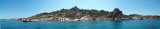
S tip, Arzachena, W of the entrance, a beacon consists of an iron post with a sheer spherical white marks a rock particularly ...
8 Sep 12
Joëlle

Isola La Maddalena (Arcipelago della Maddalena)

11nm
317°
It is the largest island of the archipelago composed of sixty islets and 7 major islands, in the NE end tip of Sardinia. It is mountainous and arid. This is the only inhabited island thoroughly.
It is connected by a bridge to Caprera island where are the house and the tomb of Garibaldi. ...
26 Nov 12
Joëlle

Isola Tavolara (Sardegna)

12nm
151°
Tavolara island is a limestone massif 6 kilometres long and 500 m wide, and 565 m high.The overhanging cliffs make it inaccessible, with the exception of a bay and a beach that is located at each end of the island, Spalmatore di Fuori northeast (military zone) and Spalmatore di Terra ...
7 May 14
Joëlle

Golfo degli Aranci (Sardegna)

6.5nm
162°
Degli Aranci gulf is is bounded, on the N, by the peninsula of which Capo Figari is the E extremity.This gulf is sheltered from NE and NW winds. Strong SE winds send in a heavy sea and storms from the N and E cause a considerable swell in the gulf. During offshore winds, which are ...
28 Sep 12
Joëlle

Golfo di Marinella (Sardegna)

4.4nm
185°
This gulf is S Cugnana gulf, S cala della Volpe. It is entered between Punta della Volpe and Punta Canigione.This gulf is the most protected area of the coast. Although the anchorage is prohibited in the Gulf because of submarine telegraph cables, many boaters anchor in this ...
23 Sep 12
Joëlle

Isola di Mortorio (Sardegna)

1.3nm
124°
Mortorio island, near Cala di Volpe, is a privately-owned uninhabited. It is part of the Archipelago of La Maddalena.

Naked island surrounded by rocks, emerged and submerged. It offers 3 bays frequented in summer.

Many birds nest on the island, would safeguard by the ...
18 Sep 12
Joëlle