Isola Tavolara (Sardegna)
6.2nm
115°
7 May 14
Joëlle
| Latitude | Longitude | |
| DMS | --- | --- |
| DM | --- | --- |
| DD | --- | --- |

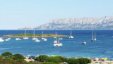
 Le golfe d'Olbia (Terranova) s'étend entre le cap Figari, au N et le cap Ceraso, au S. Le golfe degli Aranci se trouve à l'intérieur du golfe d'Olbia.
A l'intérieur du golfe se trouvent de nombreuses petites îles entourées souvent de nombreux rochers affleurants qui ne facilitent pas le passage et la manœuvre des grands bateaux commerciaux qui doivent emprunter un passage obligatoire à travers des chenaux signalés par des bouées lumineuses.
Le port d'Olbia se trouve dans la partie E d'un bras de mer long et étroit qui communique avec le fond du golfe par un étroit goulet peu visible du large. A l'entrée du goulet l'île Bocca porte un phare.
A l'E de l'île Bocca la côte est basse, débordée par des hauts-fonds. Après Liscia delle Saline, elle reprend un aspect accidenté.
La pointe Ruia (Ruja) est surmontée d'un pilier pyramidal qui s'élève sur un rocher blanc. Entre la pointe Ruia et le cap Ceraso une bouée rouge lumineuse indique les dangers de la présence de rochers.
Le golfe d'Olbia est considéré comme un excellent abri naturel, notamment des vents dominants du NW (Mistral).
 Il golfo di Olbia (Terranova) è racchiuso tra Capo Figari a nord e Capo Ceraso a sud, comprendendo anche il Golfo degli Aranci.
All'interno del golfo vi sono diversi piccoli isolotti che assieme a diversi scogli che affiorano dall' acqua non rendono semplice il passaggio e le manovre dei grandi traghetti commerciali, che hanno tuttavia un passaggio obbligato attraverso dei corridoi segnalati da boe luminose.
Il porto di Olbia si trova E di uno braccio di mare lungo e stretto che comunica con il fondo del Golfo da uno stretto canale appariscente. All'ingresso del canale l'isola Bocca dispone di uno faro.
All'E dell'isola Bocca la costa è bassa, sopraffatta da banchi. Dopo Liscia delle Saline, ha preso uno sguardo irregolare.
Il Golfo di Olbia è considerato un eccellente porto naturale, specialmente dei venti prevalente del NW (Mistrale).
Ebook | Sardegna North East
|