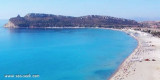
Capo S. Lorenzo (Sardegna)
1.7nm
116°
12 Oct 12
Joëlle
| Latitude | Longitude | |
| DMS | --- | --- |
| DM | --- | --- |
| DD | --- | --- |

 Between Capo Bellavista and Capo Sferracavallo, 13 miles S, the coast alternates in high rocky stretches and low, sandy, and marshy stretches.
The coast between Torre di Porto Corallo and Capo Ferrato is low, sandy, and backed by salt water lagoons. It is fringed with shoals and should not be approached within 0.5 mile.
Between Capo Ferrato and Punta dei Cappuccini, 7 miles S, the coast is mostly low and sandy, but has rocky points in places.
Monte Nai and Monte Cannas, two cone-shaped peaks, dominate this stretch of the coast. A prominent road leading to the summit can be seen on the latter mountain.
 Au S du cap Bellavista, les parties élevées et rocheuses de la côte alternent avec les parties basses, sablonneuses et marécageuses. Les caps se succèdent (cap Sferracavallo, Palmeri, S. Lorenzo).
Après le cap S. Lorenzo la côte est basse, sablonneuse et bordée d'étangs, sauf sur une longueur d'environ 3 M, immédiatement au S du cap S. Lorenzo où elle est rocheuse.
Le cap Ferratoporte porte un phare.
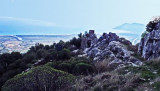
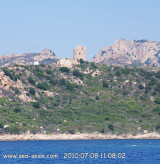
Au S de lapointe Cappuccini la côte est élevée et rocheuse.
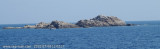
L'île Serpentara déborde la côte à 1,7 M. L'île est prolongée au N par un haut-fond d'où émergent trois gros rochers.
Puis viennent la pointe Molentis (dei Molenti) et le port Giunco qui s'ouvre entre la pointe Molentis et le cap Carbonara. S capo Bellavista, la costa alta e rocciosa si alternano con le parti inferiori, sabbiose e paludose. I capi si segono (capo Sferracavallo, Palmeri, S. Lorenzo).
Dopo il capo S. Lorenzo la costa è bassa, sabbiosa e circondata da laghetti, fatta eccezione per una lunghezza di circa 3 MN, immediatamente a S di Capo S. Lorenzo dove è rocciosa.
Il capo Ferratoporte ha un faro.
S di Lapointe Cappuccini la costa è alta e rocciosa.
L'isola di Serpentara al di là della costa a 1,7 M. L'isola si estende a N con una secca dove emergono tre rocce di grandi dimensioni.
Poi vengono la punta Molentis (dei Molenti) e il porto Giunco che si apra tra la punta Molentis e il capo Carbonara.
Ebook | Sardegna East
|