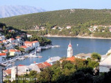
Bracki Kanal

Bracki Kanal

To precisely geolocate this site. Update if necessary.

Localisation

Characteristics

Sea
Canal

Description

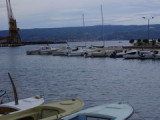
Bracki Kanal leads between the mainland and Otok Brac.
It is mostly clear and deep except in its NW part where there are several patches with depths of lessthan 10m.
The N shore of this channel is barren and desolate with mountainous terrain closely backing the coast. Sveti Fure, 1,762m high, stands 3.5 miles NNE of Makarska. This peak is the highest in the vicinity and is conspicuous because of its bare and whitish summit.
At Uvala Vrulja, located 8.5 miles NW of Makarska, a conspicuous gorge lies between the coastal mountain ranges and allows the bora to funnel through with particular violence. This wind often commences suddenly without warning even in the summer, but in the latter case it is of brief duration.
2011/06/4
Update
Jojo
Bracki Kanal s'étend entre le continent et Otok Brac.
Il est clair et profond, sauf dans sa partie nord-ouest où il y a plusieurs bancs avec des profondeurs de moins de 10m.
La rive nord de ce canal est aride et déserte avec des montagnes descendant jusqu'à la côte. Sveti Fure, haut de 1.762 m, se dresse à 3.5 miles vers le NNE de Makarska. Ce pic est le plus élevé dans les environs et il est remarquable en raison de son sommet dénudé et blanchâtre.
A Uvala Vrulja, situé à 8,5 miles au nord-ouest de Makarska, une gorge bien visible sépare les chaînes de montagnes côtières et permet le passage à la bora qui souffle avec une violence particulière. Ce vent commence souvent soudainement et sans avertissement, même en été, mais dans ce dernier cas, il est de courte durée.
2011/06/4
Update
Jojo
Ebook

Splitsko-dalmatinska županija (Split-Dalmatia Coun

  • 155 sites
  • 295 photos
  • publication date: 6 Jul 2023
  • .pdf file size: 97 Mb
Ebook

Dalmacija (Dalmatie)

  • 542 sites
  • 910 photos
  • publication date: 9 Jul 2023
  • .pdf file size: 302 Mb
Share your comments or photos on "Bracki Kanal"

Sites around Bracki Kanal

Flying distances - Direct line

Otok Ciovo

18nm
286°
Ciovo is an island in the center of the Dalmatian archipelago. This is an area of 28.8 acres (15.3 km length, width of 3.5 km). It culminates at 218 m (Mount Rudin).
O. Ciovo forms the SW side of the entrance and inner part of Kastelanski Zaliv.
At East side, Ciovo is 2km from ...
7 Aug 11
cdg2

Starogradski Zaljev Hvar

14nm
206°
Starogradski is a large deep bay, open to the NW, which houses the city and the port of Stari Grad on its SE end.
There are several bays, including its N side, where it is possible to anchor. On the other side there is an anchor in front Gradisce.
31 May 11
Jojo

Luka Omis

2.1nm
350°
Omis is a small town and a harbour located at the mouth of the river Cetina.
The city is easily identifiable by the broad gorges of the river Cetina and the fortifications on the rocks.
The port is at the bottom of the bay to the east of the river mouth.
Coming from the SE, ...
5 Jun 11
Jojo

Otoci Pakleni

20nm
223°
Plakeni islands, or Cursed Islands, are located at the W and S of Hvar town.

The islands are rocky, covered with bushes and trees. They are usually deserted, except in summer.
They offer many choices of moorings sheltered and there is a marina Palmizana.The islands'name ...
26 May 11
Jojo

Pucisca (Brac)

3.7nm
153°
Pucisca is the port and the largest city on the N side of Brac. It is a place known for a tradition of stone masons, and stone of Brac has been used for the construction of the White House in Washington among others.
The name comes from Pucisca lat. puteus: wells as sources of ...
5 Jul 11
Jojo

Dugi Rat

3.5nm
308°
Small port.
17 Dec 11
florin