Area from Key West to Dry Tortugas (Florida)

Area from Key West to Dry Tortugas (Florida)

To precisely geolocate this site. Update if necessary.

Localisation

Area from Key West to Dry Tortugas (Florida)
LatitudeLongitude
DMS------
DM------
DD------

Characteristics

Coast

Description

The area from Key West for 63 miles W to Dry Tortugas is a continuation of the keys with their intervening reefs and shoals. The keys are low, small in extent, and, except for the Dry Tortugas, generally covered with dense growths of mangrove.

Once you leave Key West, be aware that there are no services whatsoever in the remainder of the Keys headed west, not even at the Dry Tortugas National Park. There is no fresh water, no fuel, no wireless, no marinas.

2012/04/7
Update
India
Ebook

Gulf of Mexico

  • 227 sites
  • 182 photos
  • publication date: 9 Jul 2023
  • .pdf file size: 78 Mb

Florida Reefs

On the straits side of the keys, and at an average distance of 5 miles, are the Florida Reefs, a dangerous line of shoals which extend along the entire length of the chain. These reefs extend from near Stuart, on the Atlantic coast, to the Dry Tortugas, west of Key West, in the Gulf of Mexico.

The most prolific reef development occurs seaward of the Florida Keys.
The reefs here are spectacular and rival those of many Caribbean areas. Approximately 6,000 coral reefs are found between Key Biscayne and Dry Tortugas.
The reefs are particularly hazardous because they do not break in smooth weather and few of them are exposed.
The water shoals abruptly between the reefs and along their outer edges. When approaching the reefs from seaward, their proximity usually is indicated by a change in color of the water from deep blue to light green or by the bank blink.
However, too much reliance should not be placed on such indications. Lights and daybeacons facilitate navigation along the reefs in clear weather, but soundings should be resorted to in thick weather. Depths of 50 fathoms indicate a distance of 2 to 3 miles from the reefs, and great caution should be used in approaching closer. Fogs are infrequent in this area. The water always becomes milky following windy weather. The usual color is bluish green on the reefs, while the rock patches are dark, shading through brown to yellow as they approach the surface. Sand patches are bright green. Grass patches at depths of 10 to 15 feet have the appearance of rocks. With the sun astern, the line marking deep water and the edges of reefs is surprisingly clear from a position aloft.
2012/04/16
Update
JB
La zone partant de Key West, sur 63 M à l'W, vers Dry Tortugas est occupée par des keys avec leur rochers et leurs eaux peu profondes. Les keys sont basses, peu étendues, et, excepté pour les Dry Tortugas, généralement couvertes d'épaisses mangroves. 

Une fois que vous quittez Key West, sachez qu'il n'y a pas de service dans le reste des keys à l'W, même pas au parc national de Dry Tortugas. Il n'y a pas d'eau, pas de carburant, pas de port de plaisance.

2012/04/7
Update
India
Share your comments or photos on "Area from Key West to Dry Tortugas (Florida)"

Sites around Area from Key West to Dry Tortugas (Florida)

Flying distances - Direct line

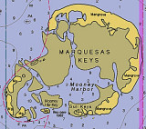
The Dry Tortugas (Florida)

24nm
281°
The Dry Tortugas are a group of small keys and reefs 63 miles W from Key West. The group is about 11 miles long, in a NE-SW direction, and 6 miles wide.
With their surrounding waters, they constitute the Dry Tortugas National Park.
The first Europeans to discover the islands ...
8 Apr 12
India

Key West National Wildlife Refuge (Florida)

32nm
82°
Key West National Wildlife Refuge (28950 Watson Boulevard, Big Pine Key, FL; 33043. E-mail: keydeer@fws.gov.
Phone: 305-872-0774) extends W from Key West to Marquesas Keys.Key West National
Wildlife Refuge was established in 1908 by President Theodore Roosevelt as a preserve ...
14 Mar 10
Joëlle

Marquesas Keys (Florida)

20nm
77°
The Marquesas Keys (not to be confused with the Marquesas Islands (French Polynesia in the Pacific Ocean) form an uninhabited island group about 30 miles (50 km) west of Key West, 4 miles (6 km) in diameter, and overgrown by mangrove. They are protected as part of the Key ...
8 Apr 12
Cham

Halfmoon Shoal (Florida)

4.6nm
17°
Halfmoon Shoal, covered 8 feet, is off the W end of The Quicksands. A wreck covered 6 feet and marked by a light is on the W edge of the shoal.
8 Apr 12
Cham

The Quicksands (Florida)

5.8nm
282°
A large shoal, the W part of which is known as The Quicksands, extends 18 miles W from the Marquesas
Keys.
The shoal is about 4.5 miles wide between the 18-foot curves and has a least depth of 2 feet over its E part.
A strong E to W current is observed in the area of The Quicksands.
8 Apr 12
Cham

Rebecca Shoal (Florida)

6.9nm
318°
 Rebecca Shoal, 43 miles W of Key West, is a small coral bank covered 11 feet. Rebecca Shoal Light (24°34'42"N., 82°35'06"W.), 66 feet above the water, is shown from a square skeleton tower on a brown pile foundation on the S edge of the shoal. A red sector ...
8 Apr 12
Cham