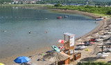
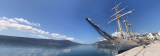
Uvala Krtole

Uvala Krtole

To precisely geolocate this site. Update if necessary.

Localisation

Uvala Krtole
LatitudeLongitude
DMS------
DM------
DD------

Characteristics

Mud Bonne tenue
Mooring

Description

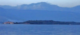
Uvala Krtole is in the area SE of Tivaski Zaljev, M Otok Island (the smallest), Stradioti (or Sveti Marko, the largest) and Prevlaka (or Ostrvo Cvijceca or "flower island", the closer the coast).
You can anchor with 5 m in this protected area of ​​the NE and N.
Coming from W, we see the steeple O. Otok. Coming towards him and go to S of the island to enter the U. Krtole.
Arriving by N, giving a wide berth to the restricted area of the arsenal of Tivat, and move towards the beacon of Tunja Pl. Let there at least 0.1 million port and sail at 193 degrees to avoid the reef which extends 0.6 m in O. Otok towards the NW. Keep the cape in U. Krtole to have exceeded O. Otok.
You can also enter into the cove through the passage of 4 m deep between the island and the Stradioti Prevlaka.
2011/04/9
Update
Jojo
Uvala Krtole
2011-04-09
Update
Jojo
Rent a Car Tivat, Montenegro http://dax.co.me/
2016/11/30
Update
DAX
Uvala Krtole se trouve dans la zone SE de Tivaski Zaljev, au S des îles Otok (la plus petite), Stradioti (ou Sveti Marko, la plus grande) et Prevlaka (ou Ostrvo Cvijceca ou "île aux fleurs", la plus près de la côte).

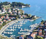
On peut mouiller par 5 m dans cette zone protégée du NE et du N.

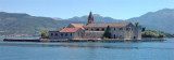
En arrivant de l'W, on voit le clocher sur O. Otok. Se diriger vers lui et passer au S de l'île pour entrer dans U. Krtole.
En arrivant par le N, donner un large tour à la zone interdite de l'arsenal de Tivat, et se diriger vers la balise de Pl. Tunja. Laisser là à au moins 0,1 M à bâbord et naviguer au 193° pour éviter le récif sous 0,6 m qui s'étend de O. Otok vers le NW. Garder ce cap dans U. Krtole jusqu'à avoir dépassé O. Otok.

On peut aussi entrer dans l'anse en empruntant le passage profond de 4 m entre l'île Stradioti et celle de Prevlaka.

2011/04/9
Update
Jojo
Ebook

Montenegro

  • 36 sites
  • 57 photos
  • publication date: 8 Jul 2023
  • .pdf file size: 25 Mb
Share your comments or photos on "Uvala Krtole"

Sites around Uvala Krtole

Flying distances - Direct line

Tivaski Zaliv

2.4nm
306°
The middle bay of Boka Kotorska, is connected to Topaljski Zaliv by Kumborski Strait, a deep passage.
This bay is steep and rocky on its S side, but the NE and NW shores, which are backed by mountains, are low and cultivated.
Uvala Kukuljina and UvalaKrtole, separated from each ...
12 Apr 11
Jojo

Uvala Polje

0.6nm
This bay is located at N Uvala Krtole.
We can anchor by 8 to 15 m in the middle of the bay.
9 Apr 11
Jojo

Ostrvo Stradioti

0.9nm
307°
Ostrvo Stradioti, the largest of the islands lying in the SE part of the bay, is 37m high and is marked by several beacons at its W extremity. It is easily recognized against the lowlands in the background.
12 Apr 11
Jojo

Marina Kalimanj Tivat

1.6nm
349°
The Marina Kalimanj in Tivat is a well protected marina, a natural harbour, where the docking locations are safe.
All around the Marina there are ancient Venetian palaces protected by UNESCO, old churches, restored stables.
The name Tivat comes from the Celtic word "teuta", meaning town.
10 Apr 11
Jojo

Plicina Jezicac

1.3nm
308°
Plicina Jezicac, nearly awash, lies at the outer end of a spit which extends about 0.5 mile WNW from the N extremity of Ostrvo Stradioti. Vessels should not attempt to pass between this reef and the islands to the E.
12 Apr 11
Jojo

Otocic Otok

1.4nm
295°
Otocic Otok, the W and smallest island in the group, can be identified by a church with a prominent belfry standing on its N shore.
12 Apr 11
Jojo