Sardegna North East

Sardegna North East

To precisely geolocate this site. Update if necessary.

Localisation

Sardegna North East
LatitudeLongitude
DMS------
DM------
DD------

Characteristics

Coast
Mooring
Restaurant

Description

NE coast extends fromPunta Tramontana to Olbia gulf. Within this area there are various sites:

Smeralda coast from Liscia di Vacca to W Ferro cape, to beyond Volpe cove.
This coast is high, rocky, jagged and generally very dry. A 12 M S Cape Ferro, Porto Cervo is an indentation of the coast where you can anchor in 8-3 m.
Attention to shoal del Cervo, covered 2.3 m and 3.5 m of water at the entrance NE of Porto Cervo.

Pevero gulf, more S, offers a good anchorage, sheltered from S winds. Attention to shoal along the SE coast of the Gulf.
At the open E of Gulf, islands dei Nibani are rocky and dark.

Congianus gulf:
 between Capaccio tip and Figari Cape.

Olbia gulf
, between Figari Cape and Cesaro Cape, includes many small islands.

Poveri islands, surrounded by dangers, are reddish and dry.
Mortoriotto island, to NE, is reddish and rough. it carries a signal at its peak.
NE, Mortorio islands are dark and very apparent.
Camere islands are covered with sparse vegetation. Most E carries a signal stone.
Soffi island is less rugged and more green.

The secondary bays of the Gulf of Congianus (Cala di Volpe, Gulf of Cugnana,) offer good anchorages.


2012/11/22
Update
Joëlle
La côte NE s'étend de la pointe Tramontana au Golfe d'Olbia. A l'intérieur de cette zone on trouve différents sites:
 La côte Smeralda: de Liscia di Vacca, à l'W du cap Ferro, jusqu'au delà de l'anse de Volpe.
Cette côte est élevée, rocheuse, très découpée et en général très aride. A 12 M au S de cap Ferro, Porto Cervo est une échancrure de la côte où on peut mouiller par 8 à 3 m.

Attention au haut-fond del Cervo, couvert de 2,3 m et 3,5 m d'eau, à l'entrée NE de Porto Cervo.
Le golfe de Pevero, plus au S, offre un bon mouillage abrité des vents de S. Attention au haut-fond le long de la côte SE du golfe.
A l'ouvert E du golfe, les îles dei Nibani sont rocheuses et de couleur sombre. Le golfe de Congianus: entre la pointe Capaccio et le cap Figari.
Le golfe d'Olbia, entre le cap Figari et le cap Cesaro, comprend de nombreuses petites îles.
Les îles Poveri, entourées de dangers, sont rougeâtres et arides.
L'île Mortoriotto est rougeâtre et accidentée. Elle porte un signal à son sommet.
Au NE, les îles Mortorio sont de couleur sombre et bien apparentes.
Les îles Le Camere sont couvertes d'une maigre végétation. La plus à l'E porte un signal en pierre.
L'île Soffi est la moins accidentée et la plus verdoyante.Les baies secondaires du golfe de Congianus (cala di Volpe, golfe de Cugnana,) offrent de bons mouillages.
2019/08/12
Update
Joëlle
NE della Sardegna comincia alla Punta Tramontana, ascenda al Golfo dell'Asinara, continua N alla Punta Falcone (punta la piu al N della Sardegna), travolti dall'archipelago della Maddalena, poi scende al capo Ferro e continua verso il SE a Olbia. All'interno di questa zona ci sono vari siti:

La Costa Smeralda: Liscia di Vacca, il W Capo Ferro, al di là della baia Volpe.
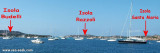
Questa costa è alta, rocciosa, frastagliata e generalmente molto secca. A 12 M S Capo Ferro, Porto Cervo è una rientranza della costa dove si può ancorare da 8-3 m.

Attenzione al banco del Cervo, coperto 2,3 m e 3,5 m di acqua all'ingresso NE di Porto Cervo.

Il Golfo di Pevero più S offre un buono ancoraggio riparato dai venti di S. Attenzione al banco lungo la costa SE del Golfo.
All'aperto E del golfo, le isole dei Nibani sono rocciose e scure.

Il Golfo di Congianus: tra la punta Capaccio e il capo Figari.

Il golfo di Olbia, tra il capo Figari e il capo Cesaro, include molti isole.

Isole dei Poveri, in mezzo a pericoli, sono rossastri e asciutto.
Al NE, l'isola Mortoriotto è rossastro e ruvida. Porta uno segnale al suo apice.
NE, le isole Mortorio sono scuro e molto evidente.
Isole Camere sono coperte di rada vegetazione. La più a E trasporta uno segnale di pietra.
L'isola Soffi è la meno ruvida e la più verde.

Le baie secondarie del Golfo di Congianus (Cala di Volpe, Golfo di Cugnana,) offrono buoniancoraggi.
2012/11/22
Update
Joëlle
Sardegna North East
Sardegna North East
View from Capo d'Orso to Isola di Santo Stefano on the left and Isola di Caprera on the right.
2019-08-12
Update
Anonymous
Ebook

Sardegna North East

  • 156 sites
  • 349 photos
  • publication date: 11 Jul 2023
  • .pdf file size: 66 Mb
Ebook

Sardegna

  • 444 sites
  • 1069 photos
  • publication date: 11 Jul 2023
  • .pdf file size: 243 Mb
Share your comments or photos on "Sardegna North East"

Sites around Sardegna North East

Flying distances - Direct line

Gendarmerie Nationale

12nm
66°
The Maddalena archipelago, located NE of Sardinia, is a National Park that keeps the small islands of Spargi, Razzoli, Budelli and Santa Maria, totally wild and surrounded by turquoise waters.
Further S La Maddalena main island and Caprera Island, inhabited offer small beaches ...
7 May 14
Joëlle

Golfo di Congianus (Sardegna)

17nm
101°
Golfo di Congianus  is entered between Punta Capaccia and Capo Figari, 7.5 miles SE. Several islands and islets lie in its NW part and its shores are high, rocky, and indented. Secondaries bays of Conjanius gulf offer good anchorages (cala di Volpe, Cugnana gulf). Several small ...
14 Sep 12
Joëlle

Golfo di Olbia (Sardegna)

18nm
118°
Le golfe d'Olbia (Terranova) s'étend entre le cap Figari, au N et le cap Ceraso, au S. Le golfe degli Aranci se trouve à l'intérieur du golfe d'Olbia.A l'intérieur du golfe se trouvent de nombreuses petites îles entourées souvent de nombreux rochers affleurants qui ne facilitent ...
29 Sep 12
Joëlle

Isola La Maddalena (Arcipelago della Maddalena)

11nm
47°
It is the largest island of the archipelago composed of sixty islets and 7 major islands, in the NE end tip of Sardinia. It is mountainous and arid. This is the only inhabited island thoroughly.
It is connected by a bridge to Caprera island where are the house and the tomb of Garibaldi. ...
26 Nov 12
Joëlle

Senetose - Tizzano

32nm
324°
SW of Corsica offers some of the most beautiful anchorages. As you get closer to Bonifacio be carreful with the weather forecast as the NW  wind can be very strong.

The range of the tide in this area is negligible. There are no regular currents along the coasts of Corse, ...
15 May 12
dd

Golfo Di Arzachena (Sardegna)

10nm
81°
Gulf of Arzachena (Arsachena), located between Punta Saline and Tre Monti Cape, is a high inlet whose banks are lined with shoals.
S tip, Arzachena, W of the entrance, a beacon consists of an iron post with a sheer spherical white marks a rock particularly ...
8 Sep 12
Joëlle