Otok Svetac (Andrija), 305m high, lies 13 miles ESE of Otocic Jabuka and is generally steep-to. The coast of the island is rocky and reddish in color on the NW side. Its SW end is fronted by a few rocks. Hrid Kamik, a dark and jagged above-water rock, lies 0.7 mile W of the SW extremity ...
Plakeni islands, or Cursed Islands, are located at the W and S of Hvar town.
The islands are rocky, covered with bushes and trees. They are usually deserted, except in summer. They offer many choices of moorings sheltered and there is a marina Palmizana.The islands'name ...
Otok Susac rises to heights of 82m in the SW part and 239m in the NE part. From a distance, this island appears as two islets. Its sides are partly wooded, cliffy, and steep-to. The eastern part is shallow and ideal for swimming. The southern part and the part of south-west are ...
Ciovo is an island in the center of the Dalmatian archipelago. This is an area of 28.8 acres (15.3 km length, width of 3.5 km). It culminates at 218 m (Mount Rudin). O. Ciovo forms the SW side of the entrance and inner part of Kastelanski Zaliv. At East side, Ciovo is 2km from ...
Pakleni Kanal lies between Pakleni Otoci and Otok Hvar. It is a deep and wide channel, with access at both ends, which leads to Luka Hvar. This channel is frequented by small vessels with local knowledge and affords good shelter from the bora, although heavy squalls may be encountered. The ...
Bisevski Kanal, 2.2 miles wide, leads between Otok Bisevo and Otok Vis. This channel, in good weather, can be used to advantage to shorten the route out of the Adriatic. However, in winter with strong winds and currents it is best avoided.


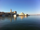


 Lighthouse in Croatia close to Italy.
 Phare croate proche de l'Italie.

