Otok Vis

Otok Vis

To precisely geolocate this site. Update if necessary.

Localisation

Characteristics

Island / Atoll

Description

Otok Vis
Otok Vis
2011-05-22
Update
Jojo
Ebook

Splitsko-dalmatinska županija (Split-Dalmatia Coun

  • 155 sites
  • 295 photos
  • publication date: 6 Jul 2023
  • .pdf file size: 97 Mb
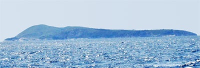
Otok Vis is the largest island in W Croatia. It is located northwest of Korcula.
During the Second World War saw was the main base of the Navy of the Resistance. The British Special Forces commandos were also on the island, fighting the Germans with the Partisans.
Until the summer of 1989, foreigners were not allowed to Vis or surrounding islands, and could not sail within 300 m of their banks.
The town of Vis, founded by Greek tribes and located deep in a vast bay, lived its heyday in the first century AD, then in the nineteenth century through the export of wine and olive oil .
The island of Vis covers an area of 90.3 square kilometers and is 17 km long and 8 km wide. With the small nearby islands of Biševo, Jabuka and Svetac, it forms a small archipelago located about fifty kilometers from the Dalmatian coast.
The Vis channel (Viski kanal) separates the north-east of the island of Hvar.
2019/01/14
Update
Jojo
Korcula- Vis
2012/02/10
Update
Otok Vis est la plus grande des îles à l'W de la Croatie. Elle est située au NW de Korcula.
Durant la seconde guerre mondiale Vis fut la base principale de la marine de la Résistance. Les commandos des Forces Spéciales Britanniques étaient aussi sur l'île, combattant les Allemands avec les Partisans.
Jusqu'à l'été 1989, les étrangers n'étaient pas autorisés sur Vis ou les îles environnantes, et ne pouvaient naviguer à moins de 300 m de leurs rivages.

La ville de Vis, fondée par des tribus grecques et située au fond d’une vaste baie, a vécu ses heures de gloire au Ier siècle après J.C., puis au XIXe siècle grâce à l’exportation de vin et d’huile d’olive.

L’île de Vis couvre une superficie de 90,3 km² et mesure 17 km de long sur 8 km de large. Avec les petites îles voisines de Biševo, Jabuka et Svetac, elle forme un petit archipel situé à une cinquantaine de kilomètres de la côte dalmate.
Le canal de Vis (Viški kanal) la sépare au nord-est de l’île de Hvar.

2011/05/22
Update
Jojo
Share your comments or photos on "Otok Vis"

Sites around Otok Vis

Flying distances - Direct line

Otok Svetac (Andrija)

3.8nm
272°
Otok Svetac (Andrija), 305m high, lies 13 miles ESE of Otocic Jabuka and is generally steep-to. The coast of the island is rocky and reddish in color on the NW side. Its SW end is fronted by a few rocks. Hrid Kamik, a dark and jagged above-water rock, lies 0.7 mile W of the SW extremity ...
25 May 11
Jojo

Otok Bisevo

7.7nm
114°
Bisevo is located SW of Vis, 4 NM Komiza. This small inhabited island has an area of 5.8 sq. km. The highest point is Strazenica (239 m). The islanders live from fishing and agriculture.
On its shores steep, there are many caves, the most famous is the Blue Cave (18 m long, 6 m ...
24 May 11
Jojo

Bisevski Kanal

9.2nm
100°
Bisevski Kanal, 2.2 miles wide, leads between Otok Bisevo and Otok Vis. This channel, in good weather, can be used to advantage to shorten the route out of the Adriatic. However, in winter with strong winds and currents it is best avoided.
24 May 11
Jojo

Otok Zirje (Sibenik)

38nm
348°
Otok Zirje is the farthest and the largest island in the Sibenik archipelago.
It is long of 6,5 NM (NW/SE) and 1,4 NM wide.
The main village, Zirje, is located in the middle of the island. A small port, luka Muna, on the coast N of Zirje, home to the ferry that connects the ...
16 Aug 11
Croatia

Otoci Pakleni

24nm
70°
Plakeni islands, or Cursed Islands, are located at the W and S of Hvar town.

The islands are rocky, covered with bushes and trees. They are usually deserted, except in summer.
They offer many choices of moorings sheltered and there is a marina Palmizana.The islands'name ...
26 May 11
Jojo

Otok Ciovo

34nm
35°
Ciovo is an island in the center of the Dalmatian archipelago. This is an area of 28.8 acres (15.3 km length, width of 3.5 km). It culminates at 218 m (Mount Rudin).
O. Ciovo forms the SW side of the entrance and inner part of Kastelanski Zaliv.
At East side, Ciovo is 2km from ...
7 Aug 11
cdg2