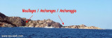
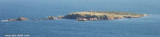
E of the E side of Caprera island, the islets of Monaci are a group of rocky and low islets and shoals. A light is shown on the SW islet.
The Monaci shoals are roks underwater that extends to the S tip of the southermost islet of Monaci, point ends on the white sand at 25 m depth.
2012/09/8
Update
Joëlle
A l'E du côté E de l'île Caprera, Les îlots de Monaci sont formés par un groupe d'îlots rocheux bas. Sur l'îlot situé au SW se trouve un phare.
Les hauts-fond de Monaci, situés à environ 1 MN à l'E des îlots de Monaci, sont une langue de roches sous l'eau qui se prolonge jusqu'à la pointe S de l'ilot le plus méridional du groupe des Monaci, pointe qui se termine sur le sable clair à 25 m de profondeur.
2012/09/8
Update
Joëlle
All'E del lato E di Caprera, gli isolotti di Monaci sono un gruppo di isolotti e secche rocciosi e bassi. Una luce è mostrato sull'isolotto SW.
La secca dei Monaci sono una lingua di roccia che prosegue sott'acqua a la punta S dell'isolotto più meridionale del gruppo dei Monaci, punta che termina sulla sabbia chiara a 25 m di profondità.
It is the largest island of the archipelago composed of sixty islets and 7 major islands, in the NE end tip of Sardinia. It is mountainous and arid. This is the only inhabited island thoroughly. It is connected by a bridge to Caprera island where are the house and the tomb of Garibaldi. ...
Gulf of Arzachena (Arsachena), located between Punta Saline and Tre Monti Cape, is a high inlet whose banks are lined with shoals. S tip, Arzachena, W of the entrance, a beacon consists of an iron post with a sheer spherical white marks a rock particularly ...
La tourelle Pecorella marque l'entrée de ce golfe qui s'enfonce à plus de 4 M dans les terres. Celle de Chiapino qui était plus au S est démolie. Il faut donc remonter suffisamment vers le N pour ne pas risquer d'en toucher les restes. En piquant vers l'W, la balise noire délimite ...
Tavolara island is a limestone massif 6 kilometres long and 500 m wide, and 565 m high.The overhanging cliffs make it inaccessible, with the exception of a bay and a beach that is located at each end of the island, Spalmatore di Fuori northeast (military zone) and Spalmatore di Terra ...
Anse au nord de la Punta Cotticio, vue du NE La Cala Cotticio au sud de lapointe Cotticio est composée de deux anses bien abritées du nord où l'on mouillera par 10 à 15m de fond. L'anse la plus occidentale est entourée de hautes falaises et il faut aller tout près ...
Isola delle Bisce, 21m high and barren, lies close N of Capo Ferro. This islet is not easily distinguishable from the land behind it.It is surrounded by shoals and flush rocks. A lighthouse stands on a tower 9 m high, on the S side of the island. On the N side of the rocky ...


 A l'E du côté E de l'île Caprera, Les îlots de Monaci sont formés par un groupe d'îlots rocheux bas. Sur l'îlot situé au SW se trouve un phare.
")