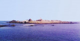
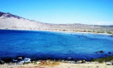
The commercial port Guacolda is closed to the town of Huasco Bajo, at the SE end of Guacolda bay.The port was used between 1851 and 1873 to ship copper ore, copper regulus, alpaca wool and hides round Cape Horn to Swansea, Glamorgan and Wales.
The port is ...
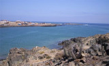
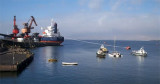
Isla Carrizal is starboard, entering Puerto Carrizal Bajo, on the tip Escoria. It is almost round and is about 6 m high.The island and the tip Escoria are connected by an isthmus of sand, shingle and mining waste. An islet, fringed by reefs, lies about 0.1 NM W of Escoria tip.
Puerto Carrizal Bajo is near Isla Carrizal. It is well sheltered from prevailing winds by this islet. During N winds a rough sea enters the port. Fogs occur usually only during the winter season. Puerto Carrizal Bajo is a small port for the shipment of iron ore. ...
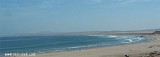
Bahia Copiapo lies S Punta Vial up to punta Dallas, even more in S. It is bordered to the center by a sandy beach and by rocks at each end. Copiapo was once a shipping ore port, but it is no longer used such as such because of the poor anchorage and landing ...
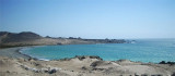
Caleta Matamoros, about 2,5 NM S punta Totoral, is well sheltered from S winds, but is open to N winds.We can anchor S cove, in 13 to 18 m. It is not recommanded to anchor near the shore in 13 m because the bottom is rocky. N winds send a heavy swell throughout the cove.
This cove is about 4 NM S of Punta Cachos.Shoals water extends from the head of Caleta Pajonal shore where two small above water rocks close NW of them. Dangerous submerged rocks lie about 0,8 NM SW of the same point. The sea breaks over these rocks and there is a heavy swell.We ...


 Isla Chanaral is almost flat except at its S end where there is a hill, 158 m high.
 Isla Chanaral est presque plate, sauf à son extrémité S où il y a une colline de 158 m de haut.
")
")