Indian Key (Florida Keys)

Indian Key (Florida Keys)

To precisely geolocate this site. Update if necessary.

Localisation

Indian Key (Florida Keys)
LatitudeLongitude
DMS------
DM------
DD------

Characteristics

Coast

Description

Indian Key  (Florida Keys)
Indian Key (Florida Keys)
2010-03-22
Update
Joëlle
Indian Key  (Florida Keys)
Indian Key (Florida Keys)
2010-03-22
Update
Joëlle
Indian Key was an unincorporated community in Monroe County, Florida, United States. It was located in the upper Florida
Key. It is currently a ghost town.
Indian Key is located about 3/4 of a mile in a southeasterly direction from the north shore of Lower Matecumbe Key.
Only slightly more than 10 acres in size and separated from the Overseas
Highway by open water, it hardly looks like a place of historic significance of Florida Keys.

Indian Key should be approached from its Southern, Hawk channel side. Shoals envelop the island to the N, and a bank of shallows shelves out from both the eastern and western banks as well.
The visitors'dock is perched off the southerly tip of Indian Key. It is rather small, and most of the space here is given over to a hour boat, which brings visitors to the park from Lower Matecumbe Key. It would be far better for captain and crew of most cruisingsized craft to dinhy in to the dock.
2010/03/23
Update
Joëlle
Indian
Key est une communauté non constituée en société dans le comté de Monroe, Floride, États-Unis. Elle était située dans l'île du haut en Floride. C'est actuellement une ville fantôme.
Indian Key est située à environ 3/4 de mile au SE de la côte N de Lower Matecumbe key.
D'une taille d'environ 4047 m² et séparée de l'autoroute qui se trouve au-dessus de la mer par la haute mer, elle a une place significative dans l'histoire des keys de Floride.

Indian Key peut être approché par le côté S de Hawk Channel. Des hauts-fonds entourent l'île au N, et un banc de hauts-fonds bordent la rive orientale et occidentale.
L'appontement des visiteurs est perché au large de la pointe S d'Indian Key. Il est assez petit et la plupart de l'espace est réservé pour une heure au bateau qui amène les visiteurs au parc depuis Lower Matecumbe Key. Il est conseillé aux plaisanciers de venir à l'appontement en annexe.

2010/03/23
Update
Joëlle
Ebook

Gulf of Mexico

  • 227 sites
  • 182 photos
  • publication date: 9 Jul 2023
  • .pdf file size: 78 Mb
Share your comments or photos on "Indian Key (Florida Keys)"

Sites around Indian Key (Florida Keys)

Flying distances - Direct line

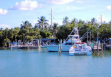
Long Key (ou Rattlesnake key) (Florida Keys)

6.4nm
247°
Long Key was called Cayo Vivora (Rattlesnake Key) by early Spanish explorers, a reference to the shape of the island, which resembles a snake with its jaws open, rather than to its denizens.
In the early 20th century, Long
Key was the site of a luxurious fishing resort that ...
5 Apr 10
Joëlle

Lower Matecumbe Key (Florida Keys)

2.3nm
249°
The island lies to the southwest of Upper Matecumbe Key, and to the northeast of Craig
Key.
All of the key is within the Village of Islamorada as of November 4, 1997, when it was incorporated.
This key is the site of a number of Indian mounds and middens, most of which were ...
22 Mar 10
Joëlle

Key Vaca (Florida Keys)

23nm
245°
Key Vaca is an island in the middle Florida
Keys, located entirely within the borders of the city of Marathon, Florida. It is often incorrectly identified as
"Marathon Key."Key Vaca is located between Fat
Deer Key and Knight's Key. Key Vaca is also connected via bridge to ...
22 Mar 10
Joëlle

Indian key anchorage (Florifa Keys)

0.1nm
238°
We can pull dinghy ashore or wade ashore for self guided tour of Island.
We used the East side of the
Island to dinghy in, wade the last few yards, and tie up to a bench or tree. There is a mooring consisting of  3-5 buoys off Indian Key's SE shores.
If any are ...
23 Mar 10
soja

Robbie's Marina (Lower Matecumbe Key)

0.7nm
287°
Just N of the 10 foot span, Robbie's Marina overlooks the western flank of Lignumvitae Channel. A large shoal separate this facility's docks from the channel. This hazard is indicated by a series of floats on a rope. To safety access the marina, you must cruise either south or north ...
23 Mar 10
JB

Lignumvitae Key (Florida Keys)

1.9nm
319°
Lignumvitae Key is an island in the upper Florida
Keys. It is located due north of, and less than one mile from the easternmost tip of Lower Matecumbe Key.
The island has the Keys' highest point above sea level of 19 feet (5.8 m), which beats the island of Key West's
Solares ...
23 Mar 10
Joëlle