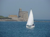
Îles Saint-Marcouf

Îles Saint-Marcouf

To precisely geolocate this site. Update if necessary.

Localisation

Îles Saint-Marcouf
LatitudeLongitude
DMS------
DM------
DD------

Characteristics

Coast

Description

Îles Saint-Marcouf
Îles Saint-Marcouf
Île du large
2011-03-08
Update
Anonymous
Îles Saint-Marcouf
Îles Saint-Marcouf
2012-05-06
Update
Geof
The islands are directly administered by the French government, and form a protected nature reserve with restricted access. Mooring is allowed between the 2 islands.
A light is shown from a square tower, 17m high, standing on Ile du Large, the NE island. Ile de Terre, lying 0.3 mile SW, is a bird sanctuary and landing is prohibited.
In very clear weather, these islands can be easily distinguished. A submarine cable extends SW from the islands to the mainland and may best be seen on the chart.
An extensive area of shallow shoal banks, lying parallel to the coast and separated from the coastal dangers, extends about
5 miles NW and about 6 miles ESE of the Iles Saint-Marcouf.
This shoal area is marked by lighted buoys.  A channel leads between this extensive area of shoal banks and the mainland shore. However, due to the numerous wrecks lying in this vicinity, local knowledge is advised.
2012/05/7
Update
Geof
Faisant partie du domaine privé de l'État, l'archipel est composé de deux îles, l'île du Large et l'île de Terre ; elles sont interdites d'accès : pour des raisons de sécurité sur l'île du Large, depuis 1999, et pour des raisons de réserve ornithologique sur l'île de Terre, depuis 1967, peuplée principalement de goélands et de cormorans. Le mouillage y est toutefois autorisé entre les deux îles.

2011/03/8
Update
Wikiadmin2
Ebook

Manche - English Channel

  • 240 sites
  • 186 photos
  • publication date: 7 Jul 2023
  • .pdf file size: 229 Mb
Share your comments or photos on "Îles Saint-Marcouf"

Sites around Îles Saint-Marcouf

Flying distances - Direct line

Rade de la Capelle

5.8nm
165°
Rade de la Capelle, a roadstead lying between Banc du Cardonnet and Baie du Grand Vey, provides anchorage sheltered from S and SW winds, in a depth of 12m, mud and sand, good holding ground. Care is necessary to avoid several dangerous wrecks lying in this vicinity.
7 May 12
Geof

Île de Tatihou

6.6nm
326°
Tatihou est une île protégée, trois hectares aux limites du fort y ont été établis en réserve ornithologique. On peut y voir des oiseaux nicheurs : goélands argentés, bruns et marins, tadornes de Belon?
27 Nov 07

Saint Vaast la Hougue

7nm
320°
Saint-Vaast-la-Hougue  is a small harbor lying 1.8 miles SW of Pointe de Saire. Ile de Tatihou, lying 1 mile E, fronts the harbor. A conspicuous tower, with a turret on one side, stands on the S extremity of the island. Fort de l’Ilet, a low fort, is situated close S of this ...
7 May 12
Geof

Grandcamp - Maisy

7.5nm
148°
Grandcamp-Maisy, a small harbor, lies 1.5 miles E of Pointe de Maisy and 4.5 miles W of Pointe de la Percee. It is used by fishing vessels and yachts. The approach channel is indicated by a lighted range. The entrance channel has a minimum width of 18m and dries 2m. The entrance is ...
7 May 12
Geof

Isigny sur Mer

10nm
170°
Isigny a small drying port, lies 1.5 miles inland on the Aure River. It is used by small coasters, fishing vessels, and pleasure craft. Passe d’Isigny, the entrance channel, is indicated by a lighted range and marked by buoys and beacons.
The inner part of this channel leads ...
7 May 12
Geof

Carentan

11nm
196°
On one of the most varied coast of La Manche, Port Carentan offers "you" an execptional site. The basin, suprounded by grass and trees, blends perfectly into the town.
The acces to Port Carentan, is through one of the most beautiful parts of "Parc Naturel des Marais du Cotentin".
Port ...
25 Nov 07