Golfo Pevero (Sardegna)

Golfo Pevero (Sardegna)

To precisely geolocate this site. Update if necessary.

Localisation

Golfo Pevero (Sardegna)
LatitudeLongitude
DMS------
DM------
DD------

Characteristics

Grass
Mooring
Sand
Beach
Sand
Rock

Description

Golfo Pevero (Sardegna)
2012-09-12
Update
Joëlle
Golfo Pevero (Sardegna)
2012-09-12
Update
Joëlle
Golfo Pevero (Sardegna)
2012-09-12
Update
Joëlle
Golfo Pevero (Sardegna)
2012-09-12
Update
Joëlle
Golfo Pevero is entered SE of Porto Cervo and offers good protection from SE and SW winds, but is open to the NE.

There are numerous small coves surrounded by rocks, where you can anchore in 11/14 m.

At the bottom there is a white sand beach of 6 km.
Beware to the shoals that are numerous.

The best anchorage is in front of the beach called the "Great Pevero" (or one side of which is next to the W, most popular and attractive, called "Little Pevero"), at the southern end of Gulf.

With W winds the best refuge is located near the coast, about half of the NW shore of the gulf, in the shallow bay of Porto Paglia, the bottom of which there is a beach, it is the most isolated and there is no houses around, but it is less beautiful.

Should be approached coast with caution and head towards the beach NE, standing at a little less than 100m from the north shore.

2012/09/14
Update
Joëlle
Le golfe de Pevero se trouve au SE de Porto Cervo et offre une bonne protection des vents du SE et du SW, mais est ouvert au NE.

On trouve de nombreuses petites anses entourées de rochers où l'on peut mouiller par 11/14 m.

Au fond on trouve une plage de sable blanc et fin de 6 km.
Attention aux hauts-fonds qui sont nombreux.

Le meilleur mouillage se trouve en face de la plage appelée le "grand Pevero" (ou à côté de celle qui est à côté vers l'W, plus fréquentée et attrayante, appelée "le petit Pevero"), à l'extrémité sud du golfe.

Avec des vents d'W le meilleur refuge se trouve près de la côte, à environ la moitié de la rive NW du golfe, dans la baie peu profonde de Porto Paglia, au fond duquel il y a une plage, c'est la plus isolée et il n'y a pas pas de maisons autour, mais elle est moins belle.

Il faut aborder la côte avec prudence et se diriger vers la plage NE, en se tenant à un peu moins de 100m de la rive nord.
2012/09/14
Update
Joëlle
Golfo Pevero si trova a SE di Porto Cervo e offre una buona protezione da venti di SE e SW, ma è aperto al NE.

Ci sono numerose calette circondate da rocce dove si puo ancorare per 11/14 m.

Nel fondo si trova una spiaggia di sabbia bianca di 6 km.
Attenzione ai banchi che sono numerosi.

L'ancoraggio migliore è davanti alla spiaggia detta del grande Pevero (o a quella contigua verso O, piu` affollata e attrezzata, detta il piccolo Pevero), all’estremita meridionale del golfo.

Con venti da O il miglior riparo si ha portandosi a ridosso della costa a circa meta della sponda nordoccidentale del golfo, nella poco profonda insenatura di Porto Paglia, al cui fondo c’è una spiaggia, piu isolata delle precedenti e senza abitazioni intorno,ma anche meno bella.

Ci si deve avvicinare alla costa con una certa prudenza e dirigendosi verso la spiaggia da NE, tenendosi a poco meno di 100m dalla sponda settentrionale.

2012/09/14
Update
Joëlle
Ebook

Sardegna North East

  • 156 sites
  • 349 photos
  • publication date: 11 Jul 2023
  • .pdf file size: 66 Mb
Golfo Pevero (Sardegna)
JB
July 2021
2021-07-16
Update
azerty
Share your comments or photos on "Golfo Pevero (Sardegna)"

Sites around Golfo Pevero (Sardegna)

Flying distances - Direct line

Golfo Di Arzachena (Sardegna)

4.2nm
278°
Gulf of Arzachena (Arsachena), located between Punta Saline and Tre Monti Cape, is a high inlet whose banks are lined with shoals.
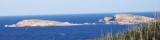
S tip, Arzachena, W of the entrance, a beacon consists of an iron post with a sheer spherical white marks a rock particularly ...
8 Sep 12
Joëlle

Isola La Maddalena (Arcipelago della Maddalena)

9.1nm
317°
It is the largest island of the archipelago composed of sixty islets and 7 major islands, in the NE end tip of Sardinia. It is mountainous and arid. This is the only inhabited island thoroughly.
It is connected by a bridge to Caprera island where are the house and the tomb of Garibaldi. ...
26 Nov 12
Joëlle

Isola Tavolara (Sardegna)

14nm
149°
Tavolara island is a limestone massif 6 kilometres long and 500 m wide, and 565 m high.The overhanging cliffs make it inaccessible, with the exception of a bay and a beach that is located at each end of the island, Spalmatore di Fuori northeast (military zone) and Spalmatore di Terra ...
7 May 14
Joëlle

Golfo degli Aranci (Sardegna)

8.8nm
156°
Degli Aranci gulf is is bounded, on the N, by the peninsula of which Capo Figari is the E extremity.This gulf is sheltered from NE and NW winds. Strong SE winds send in a heavy sea and storms from the N and E cause a considerable swell in the gulf. During offshore winds, which are ...
28 Sep 12
Joëlle

Golfo di Marinella (Sardegna)

6.3nm
169°
This gulf is S Cugnana gulf, S cala della Volpe. It is entered between Punta della Volpe and Punta Canigione.This gulf is the most protected area of the coast. Although the anchorage is prohibited in the Gulf because of submarine telegraph cables, many boaters anchor in this ...
23 Sep 12
Joëlle

Isolotti di Li Nibani (Sardegna)

1nm
70°
Nibani islands (meaning "seagull")  consisting of three major islands and numerous rocks are located on the north-eastern coast of Sardinia, SE Porto Cervo.They are separated from the mainland by the canal Delle Galere.The N islet is marked by a lighted beacon.They are part of ...
17 Sep 12
Joëlle