Fowey Rocks Light is located seven miles southeast of Cape Florida on Key Biscayne. The lighthouse was completed in 1878, replacing the Cape Florida lighthouse. It was automated on May 7, 1974 and is still in operation today.
Fowey Rocks Light (25°35'24"N., 80°05'48"W.), 110 feet above the water, is shown from a brown, octagonal, pyramidal skeleton tower on pile foundation enclosing a white dwelling and stair cylinder. A fish haven, covered 65 feet, is about 2.1 miles north-northeastward of the light in about 25°37'24"N., 80°04'54"W.
2010/04/5
Update
Renée
2010-04-05
Update
Joëlle
Fowey Rocks Light est situé à sept miles au sud de Cape Florida sur Key Biscayne. Le phare a été achevé en 1878, remplaçant le phare de Cape Florida. Il a été automatisé, le 7 mai 1974 et est toujours en opération aujourd'hui.
Fowey Rocks Light (25 ° 35'24 "N., 80 ° 05'48" O.), 33 m au-dessus de l'eau, s'élève dans une tour brune, pyramidale, octogonale sur une maison et un escalier blanc cylindre . Un refuge à poisson couvert de 19,5 m d'eau, est à environ 2,1 miles au N/NE du feu dans environ 25 ° 37'24 "N., 80 ° 04'54" O.
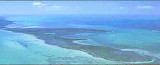
Elliott Key is the northernmost of the true Florida Keys (those 'keys' which are ancient coral reefs lifted above the present sea level), and the largest key north of Key Largo. It is located entirely within Biscayne National Park. It is bordered by the Atlantic Ocean to ...
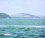
Key Biscayne is an island located in Miami-Dade County, Florida, United States, between the Atlantic Ocean and Biscayne Bay. It is the southernmost of the barrier islands along the Atlantic coast of Florida, and lies south of Miami Beach and southeast of Miami. The Key is connected ...
Miami Beach occupies the barrier beach that separates the ocean from the upper part of Biscayne Bay and is also an important yachting center. A number of causeways, with bridges over the channels, form good highway connections with Miami and the mainland communities. The city is ...
Sands Key is an island north of the upper Florida Keys in Biscayne National Park.It is located in lower Biscayne Bay, between Elliott Key and Boca Chita Key.
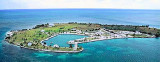
Boca Chita is a small island that is located approximately 12 miles south of the Cape Florida lighthouse on Key Biscayne, and Boca Chita Key is located approximately 9 miles from Convoy Point. WARNING!!! --- MOSQUITOES ARE REALLY BAD OVER SUMMER MONTHS! At one point, ...
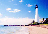
The Cape Florida lighthouse is one of the most celebrated landmarks owned by the State of Florida. The original lighthouse and cottage, built in 1825, were attacked and burned in 1836 by Seminole warriors protesting U.S. presence in the South Florida wilderness and ...


")