
Golfo Di Arzachena (Sardegna)
S tip, Arzachena, W of the entrance, a beacon consists of an iron post with a sheer spherical white marks a rock particularly ...
| Latitude | Longitude | |
| DMS | --- | --- |
| DM | --- | --- |
| DD | --- | --- |


Ebook | Sardegna North East
|
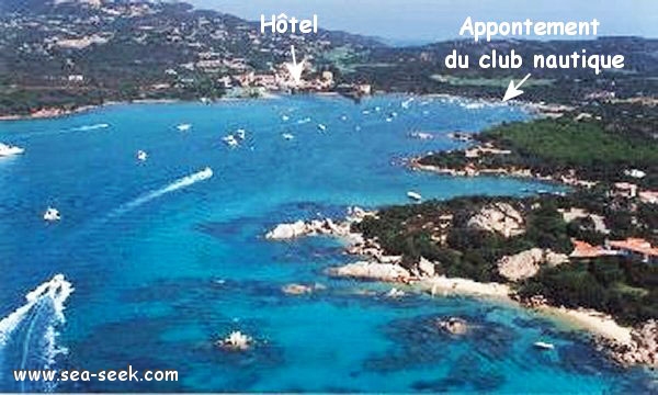
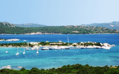
 Cala di Volpe is a natural harbor, NE Sardinia.
The entrance, flanked by two towers with red stripes and black, offers beautiful flat sandy bottom with no head rock under 4-5 meters of water.
Boats stand for most of this anchorage where only the SE winds raise a little choppy.
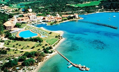
Towards the bottom of the creek, there is a channel marked by small red and white buoys along a long wooden pier. The depth does not exceed 1m at its end.
This channel joins a small harbor built below of a luxury hotel.
The basin is private, but you can dock the dock on the left as you enter for a visit to the hotel bar.
All the E coast of Cala di Volpe is unhealthy.
A long pontoon 1,50 m to 2m, moves toward the center of cala to the bottom.
You must tread move carefully to avoid the risk of running aground.
 Le pontile alla Cala di Volpe
Ebook | Sardegna
|
 Cala di Volpe est un port naturel, au NE de la Sardaigne.
A l'intérieur de cette baie sont installés des bouées de mouillage qui peuvent servir de mouillage même aux navires de grosse dimension.
L'entrée, encadrée par deux tourelles à bandes rouges et noires, présente de beaux fonds de sable plat sans aucune tête de roche sous 4 à 5 m d'eau.
Les bateaux se tiennent pour la plupart sur ce mouillage où seuls les vents du SE lèvent un peu de clapot.
Vers le fond de la calanque, on trouve un chenal balisé par des petites bouées rouges et blanches qui longent une longue estacade en bois. La profondeur ne dépasse pas 1m à son extrémité.Ce chenal rejoint un petit port aménagé au pied d'un hôtel de grand luxe. Le bassin est privé, mais on peut accoster le quai sur la gauche en entrant pour une visite au bar de l'hôtel.
Toute la côte E de la cala di Volpe est malsaine.
Un long ponton de 1,50m à 2m, s'avance vers le centre de la cala jusqu'au fond. Cala di Volpe è un porticciolo naturale nella parte nord-est della Sardegna.
All’interno dell’insenatura sono stati installati dei campi boe gestiti,che possono ospitare anche imbarcazioni di grosse dimensioni.
L'imboccatura dell'insenatura, incorniciata da due torri con strisce rosse e nere, presenta delle belle fondi di sabio piatto senza roccia sotto 4/5 m di acqua.
Barche stano per la maggior parte su questo ancoraggio dove solo i venti SE sollevano un po 'increspato.
Verso il fondo dell'insenatura, c'è un canale segnato da piccole boe rosse e bianche lungo un lungo molo di legno. La profondità non supera 1 m alla fine.
Questo canale si aggiunge un piccolo porto costruito ai piedi di un hotel di lusso. Il bacino è privato, ma è possibile attraccare al molo sulla sinistra come si entra per una visita al bar dell'hotel.
Tutta la costa E della cala di Volpe è malsano.
Un lungo pontile 1,50 m a 2 m, si sposta verso il centro della cala fino al fondo.
Deve percorrere con molta attenzione per evitare il rischio di arenarsi.


