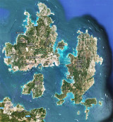
Tavolara island is a limestone massif 6 kilometres long and 500 m wide, and 565 m high.The overhanging cliffs make it inaccessible, with the exception of a bay and a beach that is located at each end of the island, Spalmatore di Fuori northeast (military zone) and Spalmatore di Terra ...
Degli Aranci gulf is is bounded, on the N, by the peninsula of which Capo Figari is the E extremity.This gulf is sheltered from NE and NW winds. Strong SE winds send in a heavy sea and storms from the N and E cause a considerable swell in the gulf. During offshore winds, which are ...
This gulf is S Cugnana gulf, S cala della Volpe. It is entered between Punta della Volpe and Punta Canigione.This gulf is the most protected area of the coast. Although the anchorage is prohibited in the Gulf because of submarine telegraph cables, many boaters anchor in this ...
Gulf of Arzachena (Arsachena), located between Punta Saline and Tre Monti Cape, is a high inlet whose banks are lined with shoals. S tip, Arzachena, W of the entrance, a beacon consists of an iron post with a sheer spherical white marks a rock particularly ...
It is the largest island of the archipelago composed of sixty islets and 7 major islands, in the NE end tip of Sardinia. It is mountainous and arid. This is the only inhabited island thoroughly. It is connected by a bridge to Caprera island where are the house and the tomb of Garibaldi. ...
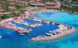
Caddinas bay is a small private port located in the bay of the same name, about the middle of the Gulf Aranci.
It is also a beautiful sandy beach.Avoid entering the port by Sirocco wind.
An access channel to the port is bounded by four green buoys to Starboard and red to ...

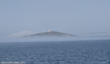


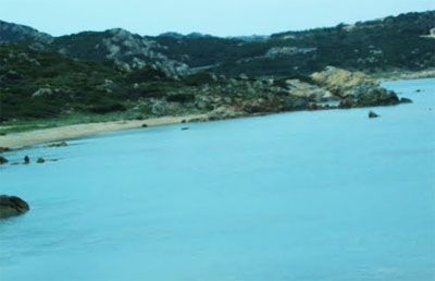
 Cala Sassari is composed of a set of three large rocks outcrops and large sandy beaches.
 Cala Sassari est composée d'un ensemble de trois grands affleurements rocheux et de grandes plages de sable fin.
 Cala Sassari è costituita da un insieme
di speroni rocciosi e tre ampie spiagge di sabbia fine.
Cala Sassari è costituita da un insieme
di speroni rocciosi e tre ampie spiagge di sabbia fine.