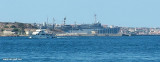
Cala Camiciotto lies between Chiesa islet and Cala Camicia on Maddalena island , just N-NE of Santo Stefano island. Port on entering the loop, there are pontoons for yachts. In front of these there is a dock pontoons strictly military.
Depth: 0.50 to 3.50 m
Berths: 160 incl. 60 for visitors (<20 m)
It is forbidden to dock at starboard on entering, it is a military zone.
2012/11/27
Update
Joëlle
2012-11-27
Update
Joëlle
La Cala Camiciotto se situe entre l'îlot Chiesa et la Cala Camicia sur l'île de la Maddalena, juste au N-NE de l'île de Santo Stefano. Sur bâbord en entrant dans l'anse, on trouve des pontons flottants pour la plaisance. En face de ces pontons il y a un quai à usage strictement militaire.
Profondeur: 0,50 à 3,50m
Places: 160 dont 60 pour les visiteurs (<20 m)
Il est interdit d'accoster au quai à tribord en entrant, celui-ci étant en zone militaire.
2012/11/27
Update
Joëlle
2012-11-27
Update
Joëlle
Cala Camiciotto si trova tra l'isolotto Chiesa e cala Camicia sull'isola della Maddalena, subito a N-NE dell'isola di Santo Stefano. Su Babordo in entrando nella cala, troviamo pontili gallegianti per le imbarcationi da diporto. Di fronte a tali pontili c'è una banchina ad uso strettamente militare.
Fondali: da 0,50 a 3,50m
Posti barca: 160 di cui 60 per il transito (<20m)
E' vietato ormeggiare sulla banchina a dritta entrando, in quanto zona militare.
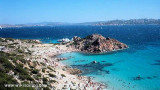
It is the largest island of the archipelago composed of sixty islets and 7 major islands, in the NE end tip of Sardinia. It is mountainous and arid. This is the only inhabited island thoroughly. It is connected by a bridge to Caprera island where are the house and the tomb of Garibaldi. ...
Gulf of Arzachena (Arsachena), located between Punta Saline and Tre Monti Cape, is a high inlet whose banks are lined with shoals. S tip, Arzachena, W of the entrance, a beacon consists of an iron post with a sheer spherical white marks a rock particularly ...
La tourelle Pecorella marque l'entrée de ce golfe qui s'enfonce à plus de 4 M dans les terres. Celle de Chiapino qui était plus au S est démolie. Il faut donc remonter suffisamment vers le N pour ne pas risquer d'en toucher les restes. En piquant vers l'W, la balise noire délimite ...
SW of Corsica offers some of the most beautiful anchorages. As you get closer to Bonifacio be carreful with the weather forecast as the NW wind can be very strong.
The range of the tide in this area is negligible. There are no regular currents along the coasts of Corse, ...
A little less than 1 NM to the E of Ventotene island, there is the island of Santo Stefano, the smallest of the archipelago.
This island is occupied by the army. Currently there is a NATO base on the island of Santo Stefano. The NATO base housed an Italian Marine barracks ...


 3 fontaines d'eau


 Cala Camiciotto lies between Chiesa islet and Cala Camicia on Maddalena island , just N-NE of Santo Stefano island.
")
 La Cala Camiciotto se situe entre l'îlot Chiesa et la Cala Camicia sur l'île de la Maddalena, juste au N-NE de l'île de Santo Stefano.
")
 Cala Camiciotto si trova tra l'isolotto Chiesa e cala Camicia sull'isola della Maddalena, subito a N-NE dell'isola di Santo Stefano.