Isola Spargi (Arch. Maddalena)

Isola Spargi (Arch. Maddalena)

To precisely geolocate this site. Update if necessary.

Localisation

Isola Spargi (Arch. Maddalena)
LatitudeLongitude
DMS------
DM------
DD------

Characteristics

Island / Atoll

Description

Isola Spargi (Arch. Maddalena)
2008-10-20
Update
Isola Spargi (Arch. Maddalena)
2008-10-20
Update
Isola Spargi (Arch. Maddalena)
2008-10-20
Update
Ebook

Sardegna North East

  • 156 sites
  • 349 photos
  • publication date: 11 Jul 2023
  • .pdf file size: 66 Mb
  Isola Spargi takes my breath away every time!
2017/10/18
Update
Abu

On peut trouver un abri contre les vents du N dans l'anse de Corsara sur la côte S de l'île.
Au fond de l'anse de Corsara une belle plage de sable
Mouillage à Corsara
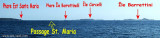
Cette île a des côtes élevées et coupées de ravins. Vue de l'W elle a un profil diminuant de hauteur du S vers le N.
Dans la partie N, le pic Banditi est un sommet à 3 pointes remarquables.
L'île est environnée de dangers. Au NW, l'îlot Spargiotto en est séparé par un passage qu'il est déconseillé d'utiliser. Au NNW et au NE, des hauts-fonds isolés s'étendent jusqu'à 0,5 M du rivage. Enfin, au SSW, la roche Corsara, couverte de 3 m d'eau, est balisée par une bouée rouge lumineuse.
2009/07/2
Update
anonymous
Share your comments or photos on "Isola Spargi (Arch. Maddalena)"

Sites around Isola Spargi (Arch. Maddalena)

Flying distances - Direct line

Isola La Maddalena (Arcipelago della Maddalena)

3nm
97°
It is the largest island of the archipelago composed of sixty islets and 7 major islands, in the NE end tip of Sardinia. It is mountainous and arid. This is the only inhabited island thoroughly.
It is connected by a bridge to Caprera island where are the house and the tomb of Garibaldi. ...
26 Nov 12
Joëlle

Golfe de Porto Vecchio

21nm
357°
La tourelle Pecorella marque l'entrée de ce golfe qui s'enfonce à plus de 4 M dans les terres. Celle de Chiapino qui était plus au S est démolie. Il faut donc remonter suffisamment vers le N pour ne pas risquer d'en toucher les restes.
En piquant vers l'W, la balise noire délimite ...
10 Jul 20
azerty

Senetose - Tizzano

30nm
307°
SW of Corsica offers some of the most beautiful anchorages. As you get closer to Bonifacio be carreful with the weather forecast as the NW  wind can be very strong.

The range of the tide in this area is negligible. There are no regular currents along the coasts of Corse, ...
15 May 12
dd

Golfo Di Arzachena (Sardegna)

8.2nm
142°
Gulf of Arzachena (Arsachena), located between Punta Saline and Tre Monti Cape, is a high inlet whose banks are lined with shoals.
S tip, Arzachena, W of the entrance, a beacon consists of an iron post with a sheer spherical white marks a rock particularly ...
8 Sep 12
Joëlle

Isola Santa Maria (Arcipelago Maddalena)

3.9nm
30°
Santa Maria is an island north of the chaplet Razzoli, Budelli and Santa Maria. It has an area of 2 km and a perimeter of ​​about 10 km.

You can anchor in the NW in Cala Muro or SE  in Cala Santa Maria.Santa Maria is separated of Razzoli by the very narrow pass degli ...
25 Nov 12
Joëlle

Isola Budelli (Arcipelago della. Maddalena)

2.5nm
Budelli Island is a few hundred meters S of Islands Razzoli and S. Maria, separated by the pass "Chiecca di Morto".It has an area of 1.6 km ² and 12.3 kilometers of coastline.
It is known for her famous pink beach, located SE of the island. Ma è vietato di avvicinamento e anche ...
25 Nov 12
Joëlle