Localisation
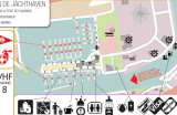
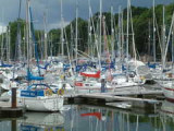
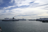
Brightlingsea (UK)
Latitude Longitude DMS --- --- DM --- --- DD --- ---
Description Ebook
North sea 102 sites 81 photos publication date: 6 Aug 2024 .pdf file size: 78 Mb
Share your comments or photos on "Brightlingsea (UK)"
Sites around Brightlingsea (UK)Flying distances - Direct line
Ramsgate
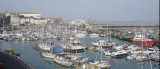
Folkestone Harbour
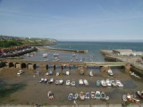
White Cliffs on Dover
Sea-Seek Sailing Guide During your navigation, remember to update the data. If a harbor, marina or anchorage is missing, create it. Thank you for all boaters.