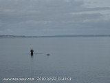
Baltic sea

Baltic sea

To precisely geolocate this site. Update if necessary.

Localisation

Baltic sea
LatitudeLongitude
DMS------
DM------
DD------

Characteristics

Coast

Description

The Baltic Sea is located in Northern Europe. It is bounded by the Scandinavian Peninsula, the mainland of Europe, and the Danish islands.

The Baltic sea is about 1600 km  long, an average of 193 km wide, and an average of 55 m  deep. The maximum depth is 459 m (1506 ft), on the Swedish side of the center.

On the long-term average, the Baltic Sea is ice-covered for about 45% of its surface area at the maximum annually. The ice-covered area during such a typical winter includes the Gulf of Bothnia, the Gulf of Finland, Gulf of Riga, Väinameri in the Estonian archipelago, the Stockholm archipelago and the Archipelago Sea. The remainder of the Baltic itself does not freeze during a normal winter, with the exception of sheltered bays and shallow lagoons such as the Curonian Lagoon. The ice reaches its maximum extent in February or March; typical ice thickness in the northernmost areas in the Bothnian Bay, the northern basin of the Gulf of Bothnia, is about 70 cm (28 in) for landfast sea ice. The thickness decreases farther south.

Freezing begins in the northern extremities of Gulf of Bothnia typically in middle of November, reaching the open waters of Bothnian Bay in early January. The Bothnian Sea, the basin south Kvarken, freezes on average in late February. The Gulf of Finland and the Gulf of Riga freeze typically in late January. In 2011, the Gulf of Finland was completely frozen on 15 February.

2011/07/25
Update
Wikiadmin2
Ebook

Baltic sea

  • 84 sites
  • 71 photos
  • publication date: 22 Jul 2024
  • .pdf file size: 70 Mb
Share your comments or photos on "Baltic sea"

Sites around Baltic sea

Flying distances - Direct line

Gulf of Bothnia

454nm
The Gulf of Bothnia (Finnish: Pohjanlahti; Swedish: Bottniska viken, i.e. Bottenviken + Bottenhavet) is the northernmost arm of the Baltic Sea.
1 Oct 10
Toto 7

Gulf of Finland

301nm
32°
Provide here details on the zone. You can put text or images.
29 Sep 10
cdg2

Stockholm Archipelago

154nm
310°

Stockholm Archipelago ... over 30,000 islets and islands / rocks to enjoy. Unspoilt and clean - a paradise for cruising boats who enjoy natural surroundings. Unhurried and friendly.
Sailor remarks
Initial impression when looking at charts of the Archipelago tend to frighten ...
26 Jul 11
Wikiadmin2

Gulf of Riga

128nm
26°
 The maximum depth of the Gulf of Riga is 67 m. The island of Saaremaa (Estonia) partially separates it from the rest of the Baltic Sea. The main exit out of the gulf is the Irbe Strait. Ruhnu island, in the middle of the gulf, also belongs to Estonia. Notable cities in this ...
26 Jul 11
Wikiadmin2

Øresund

297nm
269°
Øresund en Danish or Öresund in swedish is the sound situated between Denmark and Sweden. More precisely between the Seeland island and Scania. Oresund is the link between Baltic sea in the south and Kattegat sound in North sea direction.It is 8km long and between 3 and 4 km large. ...
29 Sep 10
cdg2

Rügen

292nm
254°
Rügen is the largest island of Germany with over twelve “Bodden” (lagoon-like waters) connected up to each other by small bays. West winds dominate and high seas have to be expected.
26 Jun 14