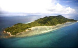
Pulau Medang - Pulau Rupat (E Sumatra)

Pulau Medang - Pulau Rupat (E Sumatra)

Per individuare con precisione. Aggiornare se necessario.

Localizzazione

Pulau Medang - Pulau Rupat (E Sumatra)
LatitudeLongitude
DMS------
DM------
DD------

Caratteristica

Isola / Atoll

Descrizione

Pulau Medang and Pulau Rupat are separated from each other by a narrow, winding strait of no importance to navigation. Both islands are heavily wooded.

Pulau Rupat is separated from the coast of Sumatera by Selat Rupat.

Foul ground, with numerous drying patches, extends about 7 miles offshore from the N side of Pulau Rupat and the NW side of Pulau Medang. A shoal with a depth of 14.7m lies 6.5 miles NNE of Tanjung Medang.

Between Tanjung Medang and Tanjung Mambul, the E entrance point of the N end of Selat Rupat, about 11 miles WSW, the tree-covered coast is bordered by a series of shoals which extend up to 5.2 miles offshore.

The NE side of Pulau Medang is tree covered and marked by some native villages. A conspicuous house with a red roof is situated about 4 miles SE of Tanjung Medang.
A detached bank, which dries on its outer side, lies about 2 miles offshore, about 6 miles SE of Tanjung Medang.


2012/01/25
Aggiornare
Jojo
Ebook

Sumatra (Indonesia)

  • 326 sites
  • 109 photos
  • publication date: 7 Aug 2024
  • .pdf file size: 109 Mb
Condividi i tuoi commenti o le foto su "Pulau Medang - Pulau Rupat (E Sumatra)"

Siti intorno a Pulau Medang - Pulau Rupat (E Sumatra)

Flying distances - Direct line

Islets SSE of Tanjung Ketam (E Sumatra)

13nm
246°
Pulau Ketam, a small islet, stands 7 miles SSE of Tanjung Ketam and Pulau Atung, Pulau Mampu, Pulau Payung, Pulau Rampang, and Pulau Mentelier stand up to 8.5 miles farther SSE. All of these islets are low but tree-covered. The entire S shore of the strait is densely wooded.
A ...
25 Jan 12
Jojo

Pyramid shoal (Malaysia)

31nm
358°
Pyramid Shoal, which lies on the N side of the SE end of South Sands, has a least depth of 3.4m, hard sand, and is the most dangerous shoal in the area because of its depth and protrusion into the fairway.
A lighted buoy is moored about 7 miles SE of Pyramid Shoal. A depth of about ...
28 Dec 11
Jojo

Water islands (Malacca - Malaysia)

44nm
76°
Between Melaka and Tanjong Seginting, about 46 miles SE, the low, thickly wooded coast is bordered by a mud bank which extends up to 2.5 miles offshore in places.
The Water Islands, centered about 8 miles SE of Melaka, consists of a group of six tree-covered islands of moderate ...
5 Jan 12
Jojo

Selat Rupat (Selat Dumai) (E Sumatra)

14nm
216°
Selat Rupat (Selat Dumai) separates Pulau Rupat from the mainland of Sumatera. Tanjung Ketam, the W entrance point of the N end of Selat Rupat, is low and sandy and is marked by some houses and coconut trees.
25 Jan 12
Jojo

Dumai harbour (E Sumatra)

15nm
210°
Dumai is a seaport town situated on the S side of Selat Rupat on the mainland coast of Sumatera directly opposite Tanjung Kapal. Dumai is an important oil loading terminal, with facilities for loading general cargo.
This is one of the main entry points into Sumatra by boat. ...
25 Jan 12
Jojo

Raleigh shoal (NE Sumatra)

20nm
54°
Raleigh Shoal, about 4 miles long in a NW to SE direction with a least depth of 4.8m, lies centered about 15 miles E of Tanjung Medang.
A shoal, with a depth of 19.4m, was reported to lie 3.5 miles NNW of Raleigh Shoal. A lighted buoy is moored on the S side of the shoal. There ...
29 Dec 11
Jojo