Machilipatnam port (Andhra Pradesh-E India)

Machilipatnam port (Andhra Pradesh-E India)

Per individuare con precisione. Aggiornare se necessario.

Localizzazione

Machilipatnam port (Andhra Pradesh-E India)
LatitudeLongitude
DMS------
DM------
DD------

Caratteristica

Porto commerciale

Descrizione

Machilipatnam (Masulipatam), the only port of the Krishna District, lies about 5 miles within the mouth of the creek of the same name about 11 miles N of Divi Point.
Vessels anchor in the roadstead to handle all cargo to and from native lighters.

Tel: +91 884 2363825 or +91 884 2376129
Fax: +91 884 2367055
Mail: mdincap@gmail.com

The gates of the tidal lock have been closed and the wharves are not used. The old wharves are partially destroyed and are used by fishing vessels. A new wharf, 60m long, lies E of the old wharves and is also used by fishing vessels.

Groynes are under development to protect the entrance to the creek and to increase depths at the entrance.

Depths in the approach to the port range from 11m, about 5.3 mile E of the entrance of the creek, to a depth of 1.8m about 1 mile offshore. The mouth of the creek is blocked by sand banks and can only be navigated at HW by vessels with a draft of less than 1.5m.

2012/03/28
Aggiornare
Jojo
Machilipatnam port (Andhra Pradesh-E India)
2012-03-28
Aggiornare
Jojo
Ebook

Bay of Bengal

  • 110 sites
  • 82 photos
  • publication date: 7 Jul 2023
  • .pdf file size: 53 Mb
Condividi i tuoi commenti o le foto su "Machilipatnam port (Andhra Pradesh-E India)"

Siti intorno a Machilipatnam port (Andhra Pradesh-E India)

Flying distances - Direct line

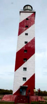
Machilipatnam Lighthouse (Andhra Pradesh-E India)

0.6nm
319°
New Machilipatnam Light is shown from a white, round, concrete tower with black bands, 3.8 miles NNE of the mouth of Machilipatnam Creek.
The great tsunami of 26 December 2004 swept away hundreds of people on the beach and reached the base of the lighthouse, but the tower was ...
28 Mar 12
Jojo

Divi point (Andhra Pradesh-E India)

10nm
195°
Divi Point is the SE extremity and False Divi Point is the SW extremity of the delta.
Ocean-going local craft use the river for about 6 months of the year.
Krishna Old Light, a white masonry tower, 44m high, lies about 9.5 miles ENE of False Divi Point. Another old lighthouse, ...
28 Mar 12
Jojo

Nagayalanka Lighthouse (Andra Pradesh-E India)

24nm
205°
Nagayalanka Lighthouse, 15 m hidh, lies 2.3 miles NW of Divi Point and is maintained as a landmark.
The station is situated near the mouths of Krishna river. There is a masonry retaining wall, which serves as jetty. A cement concrete path way for 500 m from the Lighthouse station ...
28 Mar 12
Jojo

Narasapur Point (Andhra Pradesh-E India)

32nm
71°
Narasapur Point, low and wooded, lies on the E side of the mouth of the Vasishta Godavari, which is the southernmost branch of the Godavari River.
An obelisk, 24.4m high, lies about 1 mile N of the point.
During January and February, the current sets W at a maximum rate of 2 ...
28 Mar 12
Jojo

False Divi Point (E India)

32nm
219°
False Divi Point is a low headland located at the northern end of the Coromandel Coast, in the state of Andhra Pradesh.
It is located at the apex of the Krishna River delta and covered by small mangroves. The area is low, swampy and dominated by mangroves.A bank, which dries in ...
28 Mar 12
Jojo

Hope Island (Andhra Pradesh-E India)

82nm
54°
Hope Island (16 km long sand spit from the sand carried by the waters of Godavari delta), one of a chain of similar islands which form part of the delta of the Godavari River, is low, swampy, and covered with jungle.
The area between Kakinada coast and Hope Island is known as Kakinada ...
28 Mar 12
Jojo