False Divi Point (E India)

False Divi Point (E India)

Per individuare con precisione. Aggiornare se necessario.

Localizzazione

Caratteristica

Capo

Descrizione

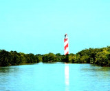
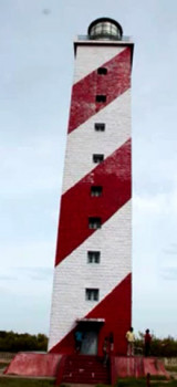
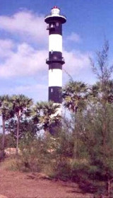
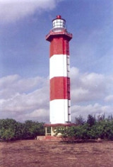
False Divi Point is a low headland located at the northern end of the Coromandel Coast, in the state of Andhra Pradesh.

It is located at the apex of the Krishna River delta and covered by small mangroves. The area is low, swampy and dominated by mangroves.

A bank, which dries in patches, extends about 1 mile S and about 3 miles W of False Divi Point.

Caution:

A bank, which dries in patches, extends about 1 mile S and about 3 miles W of False Divi Point.

The current off False Divi Point sets parallel to the coast with the prevailing monsoon, having its greatest velocity near the 185m curve about 8 miles offshore.

During March, the current off Divi Point has been found to set E at a rate of 1.5 knots.

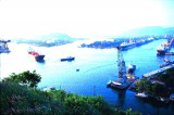
A submarine cable and pipeline area has been established between the Godavari River entrance and False Divi Point. The limits of this area, known as the Ravva Oilfield Development Area, may best be seen on the chart. Anchoring and fishing are prohibited.

The Krishna River rises in Bombay State and flows E across the peninsula of India, into the Bay of Bengal by several branches, the mouth of one being near False Divi Point.

The enormous amount of silt carried by the river has formed a wide alluvial delta which extends seaward between the towns of Nizampatam and Machilipatnam. Divi Point is the SE extremity and False Divi Point is the SW extremity of the delta.
Ocean-going local craft use the river for about 6 months of the year.

2012/03/28
Aggiornare
Jojo
Ebook

Bay of Bengal

  • 110 sites
  • 82 photos
  • publication date: 7 Jul 2023
  • .pdf file size: 53 Mb
Condividi i tuoi commenti o le foto su "False Divi Point (E India)"

Siti intorno a False Divi Point (E India)

Flying distances - Direct line

Nagayalanka Lighthouse (Andra Pradesh-E India)

10nm
72°
Nagayalanka Lighthouse, 15 m hidh, lies 2.3 miles NW of Divi Point and is maintained as a landmark.
The station is situated near the mouths of Krishna river. There is a masonry retaining wall, which serves as jetty. A cement concrete path way for 500 m from the Lighthouse station ...
28 Mar 12
Jojo

Divi point (Andhra Pradesh-E India)

23nm
49°
Divi Point is the SE extremity and False Divi Point is the SW extremity of the delta.
Ocean-going local craft use the river for about 6 months of the year.
Krishna Old Light, a white masonry tower, 44m high, lies about 9.5 miles ENE of False Divi Point. Another old lighthouse, ...
28 Mar 12
Jojo

Machilipatnam port (Andhra Pradesh-E India)

32nm
39°
Machilipatnam (Masulipatam), the only port of the Krishna District, lies about 5 miles within the mouth of the creek of the same name about 11 miles N of Divi Point.
Vessels anchor in the roadstead to handle all cargo to and from native lighters.
Tel: +91 884 2363825 or +91 ...
28 Mar 12
Jojo

Machilipatnam Lighthouse (Andhra Pradesh-E India)

33nm
38°
New Machilipatnam Light is shown from a white, round, concrete tower with black bands, 3.8 miles NNE of the mouth of Machilipatnam Creek.
The great tsunami of 26 December 2004 swept away hundreds of people on the beach and reached the base of the lighthouse, but the tower was ...
28 Mar 12
Jojo

Mutapolli Bank (E India)

36nm
247°
Mutapolli Bank, with depths of 6.4 to 11m, lies centered about 11 miles E of Kottapatnam. Overfalls usually mark this bank.
Two detached shoals, with depths of 10 to 11m, lie within 5.8 miles SW and three detached shoals, with depths of 9.1 to 11m, lie within 11.3 miles NE of this bank.
28 Mar 12
Jojo

Ramaypatnam Lighthouse (Andra Pradeh-E India)

60nm
228°
Ramaypatnam Light, from which a radiobeacon transmits, is shown from a hexagonal concrete tower lying on the coast 0.8 mile NE of the church at Ramaypatnam, built in 1870, that served as a land mark for the benefit of ships cruising off the Ramaypatnam coast.
The Lighthouse Tower ...
28 Mar 12
Jojo