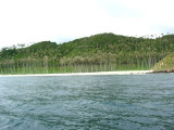
Pulau Peunasoe (Nasi) (SE Breueh)
9.1nm
290°
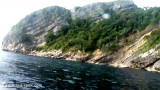
The coast line is rocky in places with sandy beaches chiefly on the W side.
11 Jan 12
Jojo
| Latitude | Longitude | |
| DMS | --- | --- |
| DM | --- | --- |
| DD | --- | --- |

") Fishing wharf
Fishing wharf")

Ebook | Andaman sea
|
 Ulee Lheue was a coastal port town near Banda Aceh, North Sumatra Indonesia. The name was made of two words. Ulèë means "head" and lheuë means” little peninsula”.
Ulee Lheue is a coastal town on the tip of Sumatra Island. was a coastal port town near Banda Aceh, North Sumatra Indonesia.
The name was made of two words. Ulèë means "head" and lheuë means” little peninsula”. Ulee Lheue is a coastal town on a narrow spit of land separating a lagoon from the sea.
In 1963, Sabang was officially declared a “Free Port”. Port Lee Lheue became the gateway to
Banda Aceh for all import cargo transiting over Sabang Free Port.
Ulee Lheue Port was completely destroyed by the tsunami of 26 December 2004. The tsunami destroyed all of the buildings in close proximity to Ulee Lheue, except for the mosque and turned the harbor and its immediate surroundings into an island. The port authority building was destroyed, but surprisingly the main wharf and the terminal, where a floating power station had been moored, (which was lifted by the force of the sea and deposited some kilometres in land), remained in tact.
In june 2005 port reconstruction was undertaken.
Ulee Lheue port information: Channel width 80 meters, harbour pond 375 meters x 150 meters, Depth 5 - 6 meters, draft along wharf 3 - 4 meters.
Fishing wharf: 100m length wharf for fish landing operations, located at the river mouth, adjacent to the bridge on the road, approaching to Ulee Lheue port.
Following major improvements to the 1.4 km breakwater and the construction of a new jetty and temporary ferry terminal, the port now manages over 900 people a day transiting the terminal, equates to a daily traffic increase by over 50 percent since 2005.
Winds—Weather.—During the Southwest Monsoon, violent gusts blow from the valley S of Ujung Masam Muka. During the Northeast Monsoon the sea and swell are heavy. The sea almost breaks in 5.5m. Land and sea breezes often blow during both seasons.
Tides—Currents.—The flood setting against the prevailing W current is weak. The ebb or W current runs longer and with greater strength than the flood. The mean rate of the flood is 0.5 knot; the ebb rate is 0.75 knot. During the Southwest Monsoon, the currents are weak.