Lhok Prialaut (N Weh)

Lhok Prialaut (N Weh)

Para ubicar con precisión. Actualizar si es necesario.

Ubicación

Lhok Prialaut (N Weh)
LatitudeLongitude
DMS------
DM------
DD------

Característica

Costa

Descripción

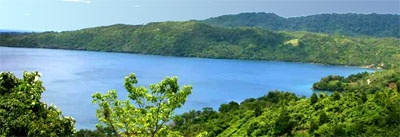
Lhok Prialaut is the bay lying between Ug Bau and Ug Seukundo. 6,5 NM appart, between wich points the bay extends S for about 4 NM, with Teluk Sabang on its E shore.
Lhok Prialaut is about 2 miles in length and breadth, with good anchorage near its head, in 16.5 to 21.9m.

Tides—Currents.—The flood, or SE current, increased by the E current which prevails N of Pulau We, sets into the strait between Pulau Rubiah and the main island at the rate of 3 knots at springs; the ebb current is much weaker.

Selat Benggala (Bengalen Passage), formed between Pulau Beueh and Pulau Weh, is about 10 miles wide and deep. It is the best approach for coastal vessels with local knowledge to the Strait of Malacca from W. Southwest or NE winds, according to the time of year, always prevail, and are fairly steady.
Vessels should approach the passage from E of Pulau Benggala (Northwest Island) to avoid the dangers between it and Pulau Breueh. There is generally a NW current of from 1 to 2 knots through the fairway of Selat Benggala.
Caution.—A small area located between the SW side of Pulau Rubiah and the main island is reported to be dangerous due to the presence mines.
2012/01/15
Actualizar
Jojo
Lhok Prialaut (N Weh)
2012-01-15
Actualizar
Jojo
Ebook

Andaman sea

  • 178 sites
  • 164 photos
  • publication date: 7 Jul 2023
  • .pdf file size: 54 Mb
Comparta sus comentarios o fotos en "Lhok Prialaut (N Weh)"

Sitios alrededor de Lhok Prialaut (N Weh)

Flying distances - Direct line

Pulau Peunasoe (Nasi) (SE Breueh)

16nm
206°
Pulau Nasi (Peunasoe or Aceh island), nearly joins the SE point of Pulau Breueh, being separated by Aroih Lam Puyang.
The coast line is rocky in places with sandy beaches chiefly on the W side.
11 Jan 12
Jojo

Ujung Batumeurunrung (N Weh)

0.5nm
306°
Ug Batumeurunrung, the E extremity of the bight in wich Pulau Rubiah is located, has above-water rocks on the reef which extends about 0.1 mile NNE.
15 Jan 12
Jojo

Pulau Rubiah (N Weh)

1.4nm
314°
Pulau Rubiah is a small island, nearly 0,9 mile in lengt, in a NW and SSE  direction, consist of small wooded hillocks, the highest being 40 m in height.
15 Jan 12
Jojo

Lhok Kruengraya (NW Weh)

2nm
78°
To the S of Pulau Klah near the head of Teluk Sabang, is Lho Krueng Raja, a small bay about 0.5 mile long and 0.25 mile wide.
It is approached by a channel less than 183m in width to the E of Pulau Klah, with depths of about 5 to 6.9m, but inside it deepens to 18.3m over mud.
13 Jan 12
Jojo

Pulau Klah (Teluk Sabang)

2.2nm
73°
Island located in Sabang bay, with an average elevation of 56 m above the sea level and can only be travelled by boat or small boat.
In this island there is a beacon to guide shipping traffic at night.

13 Jan 12
Jojo

Teluk Sabang (NE Weh)

3.1nm
63°
Teluk Sabang is nearly 1 mile in length, the entrance being about 0.4 mile wide and the depths from 20 to 40m, with a bottom of sand, coral, and gravel.
A light is shown from the N side of the entrance of Teluk Sabang.
The E side of Teluk Sabang is fronted by a bank with depths ...
13 Jan 12
Jojo