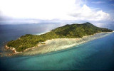
Tanjong Ru to Tanjong Piai (Malaysia)

Tanjong Ru to Tanjong Piai (Malaysia)

Para ubicar con precisión. Actualizar si es necesario.

Ubicación

Tanjong Ru to Tanjong Piai (Malaysia)
LatitudeLongitude
DMS------
DM------
DD------

Característica

Costa

Descripción

The N coast of the Strait of Malacca between Tanjung Ru and Tanjung Piai, about 166 miles SE, is only slightly indented.

Most of the shoal areas which lie off this section of coast are contained within these bights N of a line drawn between the salient points.

Port Dickson and Melaka Road are the only two ports of any commercial importance to shipping.
Many of the salient points and off-lying dangers found along this section of coast are usually well marked by navigational aids. Some of these points have been reported to be radar conspicuous.
When visible, the high peaks of the mountain ridges inland serve as good navigational aids for position fixing.

Regulations.—STRAITREP, a joint Indonesia-Malaysia-Singapore mandatory ship reporting system, operates in the Strait of Malacca and Singapore Strait.

Caution.—It has been reported that certain vessels carrying hazardous cargo have been exhibiting an all round red light.
Additionally, vessels with low freeboard use security lights underway which mask running lights by their brilliance. The security lights are used due to the increased potential of pirate activity in the straits.
Although such lighting schemes are a violation of the regulations, vessels transiting the straits should be aware of the practice and take the necessary precautions and plan accordingly.

2011/12/28
Actualizar
Jojo
Ebook

Strait of Malacca (East)

  • 83 sites
  • 69 photos
  • publication date: 11 Jul 2023
  • .pdf file size: 35 Mb
Ebook

Sumatra (Indonesia)

  • 326 sites
  • 109 photos
  • publication date: 6 Jul 2023
  • .pdf file size: 100 Mb
Comparta sus comentarios o fotos en "Tanjong Ru to Tanjong Piai (Malaysia)"

Sitios alrededor de Tanjong Ru to Tanjong Piai (Malaysia)

Flying distances - Direct line

Carey island (Selangor - Malaysia)

69nm
314°
Carey Island or Pulau Carey is an island in Selangor, Malaysia.
Carey Island is located to the south of Port Klang and north of Banting town.
It is a huge island separated from the Selangor coast by the Langat River, connected by a bridge from Chondoi and Teluk Panglima Garang ...
28 Dec 11
Jojo

Water islands (Malacca - Malaysia)

7.5nm
88°
Between Melaka and Tanjong Seginting, about 46 miles SE, the low, thickly wooded coast is bordered by a mud bank which extends up to 2.5 miles offshore in places.
The Water Islands, centered about 8 miles SE of Melaka, consists of a group of six tree-covered islands of moderate ...
5 Jan 12
Jojo

Formosa Bank - Nares Bank (Johor - Malaysia)

44nm
116°
Formosa Bank and its NW extension fronts the coast from Tanjong Tohor to Tanjong Seginting; off the latter point it merges into the 11m bank fronting the coast. The bank has a least depth of 3.3m and is steep-to on its NW and SW sides.
The bank which lies between the SE end of ...
5 Jan 12
Jojo

Pulau Melaka (Malacca - Malaysia)

8.4nm
23°
Malacca island or Pulau Melaka is a man-made island in Malacca town. it's linking to the mainland by a 30 m bridge on a side and has a jetty on the other side.
5 Jan 12
Jojo

Pulau Upeh (Malacca - Malaysia)

5.7nm
Pulau Upeh (formely known as "Liha Das Pedras", meaning place of stones), a conspicuous, densely-wooded islet, about 34m high to the tops of the trees, stands offshore about 3 miles W of St. Paul’s Hill.
Pulau Upeh is a great weekend retreat in Melaka with its first class ...
5 Jan 12
Jojo

Foulerton shoal (Malacca - Malaysia)

5.8nm
43°
Foulerton Shoal, with a depth of 10.4m, lies about 0.7 mile SSE of the lighted beacon on Pulau Panjang. A small sandy shoal, with a depth of 4.6m, lies about 0.2 mile NNW of the beacon on the E end.
5 Jan 12
Jojo