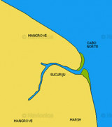

Port of Vila Do Conde (Para Brazil)
15nm
250°
17 Sep 19
Joëlle
| Latitude | Longitude | |
| DMS | --- | --- |
| DM | --- | --- |
| DD | --- | --- |


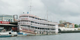
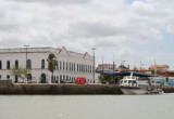
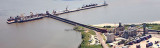
 The port of Belem is the most important commercial port on the N coast of Brazil. The port is situated on the E bank of the Rio Para about 70 miles from its mouth. Communication is maintained with all inland Amazon ports.
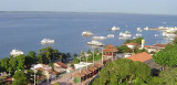
Beyond the harbour, is the site of the former yacht club. There are no longer any shore facilities here.
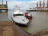
Moorings are available at the Marina B&B (001° 28.63’S 048° 28.47’W) and there is a dock where a dinghy can be safely left. Always ask the guards at the marina gate to get a taxi for you as the area around is not very safe. Take a business card with you to be able to show a taxi driver for the return trip.
Further up the river is an anchorage in front of the Hotel Beira Rio.
Most services, supplies and basic chandlery can be found in the town.
Phone: 91 3216-2129")
Ebook | SW Atlantic Ocean
|