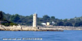
Located on the south (seaward) side of Drvenik Mali this broad open bay is exposed to weather from all
directions but the north, but does provide a good haven from the Bora.
In winds from the south or south-west avoid dropping anchor in the first
place or haul it up and head out.
It certainly makes a great location for a shorter break. For swimming
or lunch it is handy for those heading north-west or south-east along
out side of the islands such as Brac and Solta .
Anchor close in to the
shore in around 5-7 metres of water.
In year 2013 there are three buoys with the text "Restaurant" on them, in front of a small restaurant on the shore. We paid (3 adults + 2 yrs. old) approx. 80 EUR for the dinner and the buoy.
2013/07/11
Update
Située au S de Drvenik Mali
cette baie large et ouverte est exposée aux intempéries de toutes les directions, sauf le nord, mais c'est un bon refuge par Bora. Par vents du sud ou du sud-ouest éviter de jeter l'ancre. C'est certainement un excellent emplacement pour une courte pause. Pour la baignade ou le déjeuner, elle est pratique pour ceux qui vont en direction du nord-ouest ou du sud-est le long des côtés des îles telles que Brac et Solta. Mouiller près de la rive dans environ 5-7 mètres d'eau.
2011/07/7
Update
Jojo
Share your comments or photos on "Uvala Vela Rina Drvenik Mali"
Ciovo is an island in the center of the Dalmatian archipelago. This is an area of 28.8 acres (15.3 km length, width of 3.5 km). It culminates at 218 m (Mount Rudin). O. Ciovo forms the SW side of the entrance and inner part of Kastelanski Zaliv. At East side, Ciovo is 2km from ...
Island accessible only by sea. It is long about 3 m long by 2 m wide. It is 2 M NW of otok Solta.Its area is 12.07 km ² and its highest point is 178 m.It is separated from the mainland by Drvenicki Kanal. The coast of this beautiful island has remained intact and is made of many ...
Otok Zirje
is the farthest and the largest island in the Sibenik archipelago. It is long of 6,5 NM (NW/SE) and 1,4 NM wide. The main village, Zirje, is located in the middle of the island. A small port, luka Muna, on the coast N of Zirje, home to the ferry that connects the ...
Otok Svetac (Andrija), 305m high, lies 13 miles ESE of Otocic Jabuka and is generally steep-to. The coast of the island is rocky and reddish in color on the NW side. Its SW end is fronted by a few rocks. Hrid Kamik, a dark and jagged above-water rock, lies 0.7 mile W of the SW extremity ...
Very close to Drvenik Veli (1 M), Drvenik Mali, the W Drvenik Veli, made 2 M in E and W 1 M to its widest point. The coast is cut and the sea around the island is shallow. Its highest point is 79 meters high. There is a small port on the NE coast of the island. The ...


 Bonne tenue


 Located on the south (seaward) side of Drvenik Mali this broad open bay is exposed to weather from all
directions but the north, but does provide a good haven from the Bora.
In winds from the south or south-west avoid dropping anchor in the first
place or haul it up and head out.
Located on the south (seaward) side of Drvenik Mali this broad open bay is exposed to weather from all
directions but the north, but does provide a good haven from the Bora.
In winds from the south or south-west avoid dropping anchor in the first
place or haul it up and head out.

 Située au S de Drvenik Mali
cette baie large et ouverte est exposée aux intempéries de toutes les directions, sauf le nord, mais c'est un bon refuge par Bora. Par vents du sud ou du sud-ouest éviter de jeter l'ancre.
Située au S de Drvenik Mali
cette baie large et ouverte est exposée aux intempéries de toutes les directions, sauf le nord, mais c'est un bon refuge par Bora. Par vents du sud ou du sud-ouest éviter de jeter l'ancre.