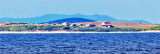
As the Vognisca and Podkujni coves, Uvala Maracol is a deep cove sheltered from all winds except from Sirocco. Many visitors mooring-buoys were set up in Uvala maracol. An officer in a boat collecting port dues and garbage. Amer: a red and white antenna on the hill and a chapel just below the ridge to the west of the cove. There are several buildings on the coast of W Uvala Maracol. It can land on the platform and reach the village across the island on foot.
2011/07/31
Update
Jojo
Comme les anses Vognisca et Podkujni, Uvala Maracol est une anse profonde abritée de tous les vents sauf du Sirocco. Un grand nombre de corps-morts visiteurs ont été mis en place dans Uvala maracol. Un préposé en barque collecte des droits de port ainsi que les ordures.
Amer: une antenne rouge et blanche sur la colline et une chapelle juste en-dessous de la crête à l'W de l'anse. Il y a plusieurs constructions sur la côte W de Uvala Maracol.
On peut débarquer sur le quai et rejoindre le village en traversant l'île à pied.
Otok Unije, a long and irregular shaped island, lies with Rt Vnetak, its SW extremity, located 7 miles NNW of Otok Susak and at W from N O. Losinj from it is separated by Unijski Kanal. The island consists of a chain of partly wooded hills and the summit, 132m high, stands in the ...
This area is located between Cape Kamenjak SW Marler and heading to the N. Seven small islands surrounded by rocks and shoals dot the entrance Medulinski Zaljev. Four tags indicate isolated rocks in the W of the bay, their presence is uncertain.The chanel between Rt Munat et ...
Kanal Vela Vrata connects the N end of Kvarner to Rijecki Zaliv and leads between the N end of Otok Cres, on the E side, and the mainland coast, on the W side. The channel is deep and clear, the bottom being formed of mud.
Rt Prostina is located at the end of Fasanski Kanal and is the N point of Luka Pula entrance. There are few bays between Rt Prostina and Rt Od Volam that defines N Premantura Peninsula.
The large natural inlet Zaljev Rasa offers the best protection of all sectors of the entire E coast of Istria, while the Bora blows strongly here. This bay is sinking into the earth near 6M, between Rt Ubac and Rt Mulac. The Rijeka Rasa flows into the bottom, creating a current that ...
Otocici Srakane, consisting of two narrow islets, extends up to 3.7 miles SE of the SE extremity of Otok Unije. These islets are partly wooded and steep-to. Hrid Silo lies close SE of the SE islet. A light is shown from a prominent structure, 10m high, standing on this rock.


 Bonne tenue
")
")
 As the Vognisca and Podkujni coves, Uvala Maracol is a deep cove sheltered from all winds except from Sirocco.
 Comme les anses Vognisca et Podkujni, Uvala Maracol est une anse profonde abritée de tous les vents sauf du Sirocco.