Otok Unije

Otok Unije

To precisely geolocate this site. Update if necessary.

Localisation

Characteristics

Coast

Description

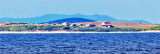
Otok Unije, a long and irregular shaped island, lies with Rt Vnetak, its SW extremity, located 7 miles NNW of Otok Susak and at W from N O. Losinj from it is separated by Unijski Kanal.
The island consists of a chain of partly wooded hills and the summit, 132m high, stands in the SE part. The shores are rocky in places and indented, especially along the E side.
A reef, marked by a beacon, extends up to 0.3 mile S from Rt Arbit, the S extremity of the island. Rt Lokunji, the N extremity of the island, is marked by a light.
The village of Unjie, with a prominent church, stands at the head of a small bay near the center of the W side of the island.

It is fronted by a small craft harbor used by local ferries.
Vessels can anchor in the bay, in depths of 20 to 25m, mud, about 0.6 mile offshore. Local knowledge is advised.

2011/07/31
Update
Jojo
Otok Unije, une île longue et de forme irrégulière, se trouve avec Rt Vnetak, son extrémité sud-ouest, située à 7 miles au NNW de Otok Susak et à l'W du N d'O. Losinj dont elle est séparée par Unijski Kanal.

L'île se compose d'une chaîne de collines en partie boisées et le sommet, à 132m de haut, se trouve dans la partie sud. Les rives sont rocheuses à certains endroits et découpées, surtout le long du côté E.

Un récif, marqué par un phare, s'étend jusqu'à 0,3 mile au S de Rt Arbit, l'extrémité S de l'île. Rt Lokunji, l'extrémité N de l'île, est marqué par un feu.

Le village de Unjie, avec une église au premier plan, est au fond d'une petite baie près du centre de la face W de l'île.
Un petit port fait face au village, il est utilisés par les ferries locaux.
Les navires peuvent mouiller dans la baie, à des profondeurs de 20 à 25m, à environ 0,6 NM au large des côtes. Il est conseillé de se renseigner localement.
2011/07/31
Update
Jojo
Ebook

Kvarner

  • 120 sites
  • 182 photos
  • publication date: 7 Jul 2023
  • .pdf file size: 69 Mb
Share your comments or photos on "Otok Unije"

Sites around Otok Unije

Flying distances - Direct line

Medulinski Zaljev

16nm
304°
This area is located between Cape Kamenjak SW Marler and heading to the N.
Seven small islands surrounded by rocks and shoals dot the entrance Medulinski Zaljev.
Four tags indicate isolated rocks in the W of the bay, their presence is uncertain.The chanel between Rt Munat et ...
26 Mar 11
Joëlle

Kanal Vela Vrata

30nm
359°
Kanal Vela Vrata connects the N end of Kvarner to Rijecki Zaliv and leads between the N end of Otok Cres, on the E side, and the mainland coast, on the W side.
The channel is deep and clear, the bottom being formed of mud.
31 Jul 11
Jojo

Otocici Srakane

4.7nm
149°
Otocici Srakane, consisting of two narrow islets, extends up to 3.7 miles SE of the SE extremity of Otok Unije.
These islets are partly wooded and steep-to.
Hrid Silo lies close SE of the SE islet.
A light is shown from a prominent structure, 10m high, standing on this rock.
1 Aug 11
Jojo

Rt Prostina à Rt Od Volam

21nm
303°
Rt Prostina is located at the end of Fasanski Kanal and is the N point of Luka Pula entrance.
There are few bays between Rt Prostina and Rt Od Volam that defines N Premantura Peninsula.
2 Sep 11
Jojo

Zaljev Rasa

22nm
338°
The large natural inlet Zaljev Rasa offers the best protection of all sectors of the entire E coast of Istria, while the Bora blows strongly here. This bay is sinking into the earth near 6M, between Rt Ubac and Rt Mulac. The Rijeka Rasa flows into the bottom, creating a current that ...
5 Sep 11
Jojo

Olipski Kanal

25nm
126°
Olipski Kanal leads NNW between the E side of Otok Silba and the W side of Otok Olib and merges into the N end of Pohlipski Kanal.
This channel is deep and has a minimum navigable width of 0.7 mile. It is often used by vessels proceeding to and from Zadar.
Good anchorage is ...
18 Sep 11
Jojo