Unijski Kanal

Unijski Kanal

To precisely geolocate this site. Update if necessary.

Localisation

Characteristics

Sea
Canal
Mooring

Description

Unijski Kanal leads between Otok Unije and Otococi Srakane, at the W side, and Otok Losinj, at the E side.

This passage is partially landlocked and affords good shelter for a large number of vessels. It is reported to be a refuge for fishing vessels.

Anchorage can be taken nearly anywhere, according to draft and shelter required, but the bottom close to the shore of Otok Losinj is reported to be rocky.

The currents in the channel are tidal and are affected by the winds. The flood current is reported to sometimes attain a rate up to 2.5 knots.

Loaded tankers greater than 500 gross tons are prohibited from using Unijski Kanal.

2011/08/2
Update
Jojo
Unijski Kanal passe entre Otok Unije et Otococi Srakane, sur le côté W, et Otok Losinj, sur le côté E.
Ce passage est partiellement enclavé et offre un bon abri pour un grand nombre de navires. On dit qu'il serait un refuge pour les navires de pêche.
On peut mouiller à peu près partout, selon le TE et l'abri nécessaire, mais au fond près du rivage de Otok Losinj le fond est rocheux.
Les courants dans le chenal sont influencés par la marée et par les vents. Le courant de crue peut atteindre parfois 2,5 noeuds.
Les pétroliers chargés de plus de 500 tonnes de jauge brute ont interdiction d'utiliser Unijski Kanal.
2011/08/2
Update
Jojo
Ebook

Kvarner

  • 120 sites
  • 182 photos
  • publication date: 7 Jul 2023
  • .pdf file size: 69 Mb
Share your comments or photos on "Unijski Kanal"

Sites around Unijski Kanal

Flying distances - Direct line

Otok Unije

2.9nm
275°
Otok Unije, a long and irregular shaped island, lies with Rt Vnetak, its SW extremity, located 7 miles NNW of Otok Susak and at W from N O. Losinj from it is separated by Unijski Kanal.
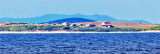
The island consists of a chain of partly wooded hills and the summit, 132m high, stands in the ...
31 Jul 11
Jojo

Medulinski Zaljev

19nm
299°
This area is located between Cape Kamenjak SW Marler and heading to the N.
Seven small islands surrounded by rocks and shoals dot the entrance Medulinski Zaljev.
Four tags indicate isolated rocks in the W of the bay, their presence is uncertain.The chanel between Rt Munat et ...
26 Mar 11
Joëlle

Otocici Srakane

3.7nm
187°
Otocici Srakane, consisting of two narrow islets, extends up to 3.7 miles SE of the SE extremity of Otok Unije.
These islets are partly wooded and steep-to.
Hrid Silo lies close SE of the SE islet.
A light is shown from a prominent structure, 10m high, standing on this rock.
1 Aug 11
Jojo

Olipski Kanal

22nm
130°
Olipski Kanal leads NNW between the E side of Otok Silba and the W side of Otok Olib and merges into the N end of Pohlipski Kanal.
This channel is deep and has a minimum navigable width of 0.7 mile. It is often used by vessels proceeding to and from Zadar.
Good anchorage is ...
18 Sep 11
Jojo

Kanal Vela Vrata

30nm
354°
Kanal Vela Vrata connects the N end of Kvarner to Rijecki Zaliv and leads between the N end of Otok Cres, on the E side, and the mainland coast, on the W side.
The channel is deep and clear, the bottom being formed of mud.
31 Jul 11
Jojo

Otok Olib Zadar

24nm
128°
Otok Olib is located E of O. Silba. It belongs to Zadar archipelago.The island has been inhabited since Roman times. The residents bought their island in 1900. The only village on the island was established around the port.
To the east of the island you will find some small hidden ...
27 Jul 11
Jojo