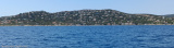
Golfe de Saint-Tropez is entered between Pointe de la Rabiou and Cap Sardinaux, 2 miles N, and extends for about 4 miles WSW. On approaching the gulf, the following conspicuous landmarks can easily be identified:
Chateau Borelly, which consists of a group of buildings surrounding a tower, standing 0.5 mile S of Pointe de la Rabiou.
Saint-Tropez, standing on the S shore, which with its citadel and church tower, appears as a white mass.
A water tower, 46m high, standing 0.7 mile SW of Saint-Tropez.
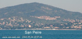
Saint Maxime, standing on the N bank and containing several large hotels and a casino building.
A distinctive tabular mountain standing in the background at the head of the gulf with a higher and conical peak close N of it.
2007/12/16
Update
St Tropez un des plus beaux golfes de la Côte d'Azur, face à Sainte-Maxime, séparé, à l'Est, de la gracieuse baie des Canoubiers (un mouillage très apprécié des plaisanciers) par un promontoire que couronne sa citadelle. Le petit port de Saint-Tropez est devenu une station dont le monde de la presse, des lettres, des arts et particulièrement du spectacle, a fait l'un des carrefours d'été de l'europe.
Prohibited areas, the limits of which are shown on the chart, lie SW of Pointe du Titan (Ile du Levant) and extend up to 2 miles from the coast. These areas, which are used by French naval vessels, are not in force between July 1 and August 31. Vessels are prohibited from approaching ...
Mouillage avec fond de sable par 5 à 7 mètres de fond.Site assez sympathique malgré la proximité de la route repérable par la forme ronde caractéristique du restaurant sur la droite de la calanque en arrivant devantA éviter par vent d'Est
Access: green and red conical buoys (1/5 to 1/12). Narrow chanel, keep in the center of the channel. Access difficult in E winds, not recommended at night. 20 B. inc. 2 visit. (<13m) Depth: basin 1,70m
Port well sheltered from Mistral and Ponant. Beware: a flat marked by a green pole 100 m to starboard when entering the harbour to be given a wide berth when arriving from the N. 130 B. inc. 8 visit (<10m)
This bay is bordered by numerous villas, and a large white building, which is very prominent from seaward, stands on its N shore. The bay offers shelter from NW winds, but the anchorage is untenable with winds from seaward. Vessels may anchor to seek shelter from the Mistral, ...


 Golfe de Saint-Tropez is entered between Pointe de la Rabiou and Cap Sardinaux, 2 miles N, and extends for about 4 miles WSW. On approaching the gulf, the following conspicuous landmarks can easily be identified:
 St Tropez un des plus beaux golfes de la Côte d'Azur, face à Sainte-Maxime, séparé, à l'Est, de la gracieuse baie des Canoubiers (un mouillage très apprécié des plaisanciers) par un promontoire que couronne sa citadelle. Le petit port de Saint-Tropez est devenu une station dont le monde de la presse, des lettres, des arts et particulièrement du spectacle, a fait l'un des carrefours d'été de l'europe.


.jpg)